Category:Maps of Pécs
Jump to navigation
Jump to search
Wikimedia category | |||||
| Upload media | |||||
| Instance of | |||||
|---|---|---|---|---|---|
| Category combines topics | |||||
| Pécs | |||||
city in Hungary 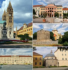 Clockwise from top left: Cathedral, Széchenyi Square, Barbican, Jakovali Hassan Mosque, Kossuth Square | |||||
| Pronunciation audio | |||||
| Instance of |
| ||||
| Location | Pécs District, Baranya County, Hungary | ||||
| Official language | |||||
| Head of government |
| ||||
| Significant event |
| ||||
| Population |
| ||||
| Area |
| ||||
| Elevation above sea level |
| ||||
| Different from | |||||
| official website | |||||
 | |||||
Subcategories
This category has the following 2 subcategories, out of 2 total.
- Old maps of Pécs (4 F)
P
Media in category "Maps of Pécs"
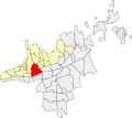
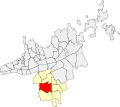
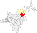
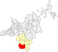
The following 61 files are in this category, out of 61 total.
-
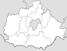
BaranyaCounty.png 301 × 198; 4 KB
-
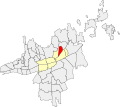
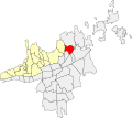
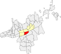
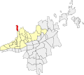
Budai városrész (Pécs).svg 860 × 765; 94 KB
-
Bálics.svg 860 × 765; 94 KB
-
Csatolt Falvak (Pécs).svg 860 × 765; 94 KB
-
Csoronika.svg 860 × 765; 94 KB
-
Map of Balokány (Pécs).svg 860 × 765; 94 KB
-
Map of Basamalom (Pécs).svg 860 × 765; 94 KB
-
Map of Bolgárkert (Pécs).svg 860 × 765; 94 KB
-
Map of Deindol (Pécs).svg 860 × 765; 94 KB
-
Map of Diós (Pécs).svg 860 × 765; 94 KB
-
Map of Donátus (Pécs).svg 860 × 765; 94 KB
-
Map of Fogadó (Pécs).svg 860 × 765; 94 KB
-
Map of Füzes (Pécs).svg 860 × 765; 94 KB
-
Map of Gyárváros (Pécs).svg 860 × 765; 94 KB
-
Map of Gyükés (Pécs).svg 860 × 765; 94 KB
-
Map of Havihegy (Pécs).svg 860 × 765; 94 KB
-
Map of Hird (Pécs).svg 860 × 765; 94 KB
-
Map of Ispitaalja (Pécs).svg 860 × 765; 94 KB
-
Map of Kertváros (Pécs).svg 860 × 765; 94 KB
-
Map of Kovácstelep (Pécs).svg 860 × 765; 94 KB
-
Map of Makár (Pécs).svg 860 × 765; 94 KB
-
Map of Mecsekoldal (Pécs).svg 860 × 765; 94 KB
-
Map of Mecsekoldal.svg 860 × 765; 94 KB
-
Map of Mecsekszabolcs (Pécs).svg 860 × 765; 94 KB
-
Map of Megyer (Pécs).svg 860 × 765; 94 KB
-
Map of Meszes (Pécs).svg 860 × 765; 94 KB
-
Map of Meszes-Pécsbánya (Pécs).svg 860 × 765; 94 KB
-
Map of Málom (Pécs).svg 860 × 765; 94 KB
-
Map of Nagyárpád (Pécs).svg 860 × 765; 94 KB
-
Map of Nyugati Ipari Övezet (Pécs).svg 860 × 765; 93 KB
-
Map of Patacs (Pécs).svg 860 × 765; 94 KB
-
Map of Piricsizma (Pécs).svg 860 × 765; 93 KB
-
Map of Postavölgy (Pécs).svg 860 × 765; 93 KB
-
Map of Pécs South.svg 860 × 765; 94 KB
-
Map of Pécs SouthEast.svg 860 × 765; 94 KB
-
Map of Pécs.png 1,601 × 1,025; 50 KB
-
Map of Pécs.svg 1,604 × 1,431; 20 KB
-
Map of Pécsbánya (Pécs).svg 860 × 765; 94 KB
-
Map of Rigóder (Pécs).svg 860 × 765; 93 KB
-
Map of Rácváros (Pécs).svg 860 × 765; 93 KB
-
Map of Rókusdomb (Pécs).svg 860 × 765; 93 KB
-
Map of Siklósi külváros (Pécs).svg 860 × 765; 93 KB
-
Map of Somogy (Pécs).svg 860 × 765; 93 KB
-
Map of Szentkút (Pécs).svg 860 × 765; 93 KB
-
Map of Szentmiklós (Pécs).svg 860 × 765; 94 KB
-
Map of Szigeti külváros (Pécs).svg 860 × 765; 94 KB
-
Map of Szkókó (Pécs).svg 860 × 765; 94 KB
-
Map of Tüskésrét (Pécs).svg 860 × 765; 93 KB
-
Map of Uránváros (Pécs).svg 860 × 765; 93 KB
-
Map of Uránváros.svg 860 × 765; 94 KB
-
Map of Vasas (Pécs).svg 860 × 765; 93 KB
-
Map of Zsebedomb (Pécs).svg 860 × 765; 94 KB
-
Map of Északmegyer (Pécs).svg 860 × 765; 94 KB
-
Map of Újhegy (Pécs).svg 860 × 765; 93 KB
-
Map of Ürög (Pécs).svg 860 × 765; 93 KB
-
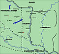
PannoniaValeria.jpg 1,306 × 1,190; 505 KB
-
Pécs 80 Bus Map.svg 2,500 × 2,500; 15 KB
-
Pécs 901 Bus Map.svg 2,500 × 2,500; 16 KB
-
Pécs Belső városrészek.svg 860 × 765; 94 KB
-
Pécs Belváros.svg 860 × 765; 94 KB
-
Árpádváros.svg 889 × 791; 85 KB


