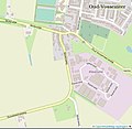
Category:Maps of Oud-Vossemeer
Jump to navigation
Jump to search
| NO WIKIDATA ID FOUND! Search for Maps of Oud-Vossemeer on Wikidata | |
| Upload media |
Media in category "Maps of Oud-Vossemeer"
The following 10 files are in this category, out of 10 total.
-
Botshoofd Tholen OSM.jpg 891 × 841; 131 KB
-
Kadastrale kaart 1811-1832, minuutplan Oud Vossemeer, Zeeland, sectie F, blad 03.jpg 11,956 × 8,322; 14.91 MB
-
Map - NL - Tholen - Wijk 06 Oud-Vossemeer.svg 625 × 575; 17 KB
-
Map NL - Tholen - Oud-Vossemeer.png 800 × 600; 12 KB
-
Onder de Molen Oud-Vossemeer Tholen.jpg 777 × 759; 102 KB
-
OudVossemeer 1865.gif 2,600 × 3,344; 768 KB


