Category:Maps of Otzberg
Jump to navigation
Jump to search
Media in category "Maps of Otzberg"
The following 7 files are in this category, out of 7 total.
-
 Breitenstein Schluchten.jpg 1,620 × 1,438; 1,017 KB
-
 Hering Hist Karte markiert.jpg 559 × 581; 315 KB
-
 Karte des Oberamts Lichtenberg.jpg 4,672 × 3,964; 7.92 MB
-
 Karte Otzberg Habitzheim.jpg 3,641 × 3,757; 786 KB
-
 Karte Otzberg Lengfeld.jpg 3,641 × 3,757; 780 KB
-
 Lidar Schummerung Breitenstein.jpg 793 × 820; 142 KB
-
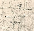 Otzberg 1832-1850.jpg 1,297 × 1,182; 639 KB


