Category:Maps of Ontario provincial elections
Jump to navigation
Jump to search
Subcategories
This category has the following 5 subcategories, out of 5 total.
Media in category "Maps of Ontario provincial elections"
The following 8 files are in this category, out of 8 total.
-
 Ontario general election, 1987 results by riding.svg 1,847 × 1,237; 453 KB
-
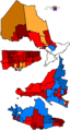
 Ontario Provincial Election 1990 - Results Map.svg 1,847 × 1,237; 428 KB
-
 Ontario Provincial Election 1995 - Results Map.svg 1,847 × 1,237; 431 KB
-
 Ontario general election, 1999 results by riding.svg 1,967 × 1,476; 450 KB
-
 Ontario Provincial Election, 2003 - Results By Riding.svg 1,967 × 1,476; 426 KB
-
 Ont1999.PNG 1,088 × 2,040; 106 KB
-
 Ont2003.PNG 1,088 × 2,040; 31 KB
-
 Ontario1990.PNG 1,115 × 2,419; 134 KB


