Category:Maps of Okinawa Islands
Jump to navigation
Jump to search
English: Category for maps of Okinawa Islands in Okinawa Prefecture, Japan
日本語: 沖縄県・沖縄諸島の地図に関するカテゴリ
Wikimedia category | |||||
| Upload media | |||||
| Instance of | |||||
|---|---|---|---|---|---|
| Category combines topics | |||||
| Okinawa Islands | |||||
Japanese islands      | |||||
| Instance of |
| ||||
| Part of | |||||
| Named after | |||||
| Location | Okinawa Prefecture, Japan | ||||
| Located in or next to body of water | |||||
| Has part(s) | |||||
| Area |
| ||||
| Elevation above sea level |
| ||||
 | |||||
Subcategories
This category has the following 2 subcategories, out of 2 total.
K
- Maps of the Kerama Islands (5 F)
O
Media in category "Maps of Okinawa Islands"
The following 32 files are in this category, out of 32 total.
-
 11管区 在日米軍 訓練水域区域.png 2,045 × 1,134; 549 KB
-
 1944 Okinawa Enemy Dispositions (30249095573).jpg 6,479 × 5,312; 2.36 MB
-

-

-
 Atoll research bulletin (1996) (20352165191).jpg 2,050 × 2,864; 1.83 MB
-
 Boundaries of the Okinawan Languages.svg 800 × 652; 21 KB
-
 Flag map of Ryukyu.png 2,560 × 1,488; 196 KB
-
 Genroku Kuniezu - Ryūkyū Kingdom - Okinawa Island+ (National Archives of Japan).jpg 6,078 × 10,819; 6.49 MB
-
 Geographic locations of the populations studied in Japan.png 2,067 × 1,480; 952 KB
-
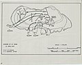
 Ie defence positions.png 1,217 × 724; 803 KB
-
 Iheya - Izena islands (1).png 448 × 763; 67 KB
-
 Iheya - Izena islands.png 1,609 × 2,737; 297 KB
-
 Invasion of Ie Shima - NARA - 100307404.jpg 6,400 × 5,053; 1.07 MB
-
 Io-torishima.png 334 × 378; 39 KB
-
 Japan National Route 58 Map.png 524 × 888; 26 KB
-
 Japan Okinawa OkinawaIslands Map1.png 2,999 × 2,046; 738 KB
-
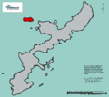 JP Okinawa Ie-jima Location.png 1,351 × 1,206; 35 KB
-
 Map of Hamahiga Island.png 1,185 × 1,289; 63 KB
-
 Map of Kuba Island, Zamami.png 813 × 1,225; 181 KB
-
 Map of Okinawa Islands 02.svg 1,000 × 750; 479 KB
-
 Map of Okinawa Islands Sannan.png 2,389 × 1,709; 931 KB
-
 Map of Okinawa Islands.png 2,389 × 1,709; 951 KB
-
 Map of Yakabi Island.png 749 × 1,045; 148 KB
-
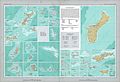 National Atlas of the USA 1970 - Pacific Outlying Areas.jpg 4,170 × 2,836; 2.04 MB
-
 Okinawa Island group.jpg 800 × 566; 45 KB
-
 Okinawa Islands map.png 962 × 912; 460 KB
-
 Okinawa Islands.gif 288 × 165; 6 KB
-
 Okinawa-eilanden.PNG 748 × 425; 36 KB
-
 Okinawa-Guntō.jpg 1,135 × 707; 292 KB
-
 Okinawa.svg 1,052 × 744; 33 KB
-
 Yagaji Island in Okinawa.gif 558 × 680; 29 KB
-
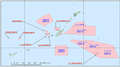
 Yokatsu Islands.png 2,260 × 2,150; 711 KB

.jpg)
.jpg)
.jpg)
_(20352165191).jpg)


.jpg)


.png)


