Category:Maps of Nyer
Jump to navigation
Jump to search
Wikimedia category | |||||
| Upload media | |||||
| Instance of | |||||
|---|---|---|---|---|---|
| Category combines topics | |||||
| Nyer | |||||
commune in Pyrénées-Orientales, France  El castell de Nyer on visqueren els Banyuls   | |||||
| Pronunciation audio | |||||
| Instance of | |||||
| Location | |||||
| Located in or next to body of water | |||||
| Head of government |
| ||||
| Population |
| ||||
| Area |
| ||||
| Elevation above sea level |
| ||||
 | |||||
Media in category "Maps of Nyer"
The following 13 files are in this category, out of 13 total.
-
 66123-Nyer-argile.png 4,076 × 3,307; 9.68 MB
-
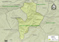
 66123-Nyer-Natura2000.png 5,846 × 4,133; 12.34 MB
-
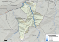
 66123-Nyer-Routes-Hydro.png 3,507 × 2,480; 1.11 MB
-
 66123-Nyer-Sols.png 3,270 × 2,598; 1.85 MB
-
 66123-Nyer-ZNIEFF1.png 3,057 × 2,480; 6.74 MB
-
 66123-Nyer-ZNIEFF2.png 3,519 × 2,480; 7.29 MB
-
 66123-Nyer-Zone inondable.png 4,677 × 3,307; 11.57 MB
-
 En el 1812.png 515 × 416; 428 KB
-
 Localització de Nyer respecte del Conflent.svg 428 × 323; 239 KB
-
 Map commune FR insee code 66123.png 756 × 605; 79 KB
-
 Nyer el 1812.png 505 × 424; 445 KB
-
 Nyer en el Conflent.png 862 × 600; 57 KB
-
 Périmètre RNR Nyer rnr128.png 998 × 817; 491 KB


