Category:Maps of Northern Cape municipalities with 2006 borders
Jump to navigation
Jump to search
This category contains maps of municipalities in the Northern Cape province of South Africa that show the the municipal borders as they were after the municipal election of 1 March 2006. The borders of many municipalities changed in 2011.
Media in category "Maps of Northern Cape municipalities with 2006 borders"
The following 87 files are in this category, out of 87 total.
-
 Blank map of the Northern Cape (2006).svg 699 × 716; 1.17 MB
-
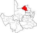
 DC45 locator.svg 1,000 × 899; 287 KB
-
 DC6 locator.svg 1,000 × 899; 287 KB
-
 DC7 locator.svg 1,000 × 899; 287 KB
-
 DC8 locator.svg 1,000 × 899; 287 KB
-
 DC9 locator.svg 1,000 × 899; 287 KB
-
 Map of the Northern Cape with Frances Baard highlighted (2006).svg 750 × 764; 544 KB
-
 Map of the Northern Cape with John Taolo Gaetsewe highlighted (2006).svg 750 × 764; 539 KB
-
 Map No. 41 of Schedule 2 to Notice 1998 of 2005.png 2,800 × 1,950; 3.75 MB
-
 Map No. 42 of Schedule 2 to Notice 1998 of 2005.png 2,800 × 1,950; 4 MB
-
 Map No. 43 of Schedule 2 to Notice 1998 of 2005.png 2,800 × 1,950; 3.69 MB
-
 Map No. 44 of Schedule 2 to Notice 1998 of 2005.png 2,800 × 1,950; 3.71 MB
-
 Map No. 45 of Schedule 2 to Notice 1998 of 2005.png 2,970 × 2,050; 4.09 MB
-
 Map of the Northern Cape with !Kheis highlighted (2006).svg 750 × 764; 538 KB
-
 Map of the Northern Cape with Dikgatlong highlighted (2006).svg 750 × 764; 535 KB
-
 Map of the Northern Cape with Emthanjeni highlighted (2006).svg 750 × 764; 537 KB
-
 Map of the Northern Cape with Ga-Segonyana highlighted (2006).svg 750 × 764; 534 KB
-
 Map of the Northern Cape with Gamagara highlighted (2006).svg 750 × 764; 532 KB
-
 Map of the Northern Cape with Hantam highlighted (2006).svg 750 × 764; 544 KB
-
 Map of the Northern Cape with Joe Morolong highlighted (2006).svg 750 × 764; 536 KB
-
 Map of the Northern Cape with Kai !Garib highlighted (2006).svg 750 × 764; 540 KB
-
 Map of the Northern Cape with Kamiesberg highlighted (2006).svg 750 × 764; 542 KB
-
 Map of the Northern Cape with Kareeberg highlighted (2006).svg 750 × 764; 538 KB
-
 Map of the Northern Cape with Karoo Hoogland highlighted (2006).svg 750 × 764; 549 KB
-
 Map of the Northern Cape with Kgatelopele highlighted (2006).svg 750 × 764; 532 KB
-
 Map of the Northern Cape with Khara Hais highlighted (2006).svg 750 × 764; 534 KB
-
 Map of the Northern Cape with Khâi-Ma highlighted (2006).svg 750 × 764; 537 KB
-
 Map of the Northern Cape with Magareng highlighted (2006).svg 750 × 764; 534 KB
-
 Map of the Northern Cape with Mier highlighted (2006).svg 750 × 764; 539 KB
-
 Map of the Northern Cape with municipalities blank (2006).svg 750 × 764; 1.33 MB
-
 Map of the Northern Cape with Nama Khoi highlighted (2006).svg 750 × 764; 542 KB
-
 Map of the Northern Cape with Phokwane highlighted (2006).svg 750 × 764; 533 KB
-
 Map of the Northern Cape with Renosterberg highlighted (2006).svg 750 × 764; 536 KB
-
 Map of the Northern Cape with Richtersveld highlighted (2006).svg 750 × 764; 544 KB
-
 Map of the Northern Cape with Siyancuma highlighted (2006).svg 750 × 764; 547 KB
-
 Map of the Northern Cape with Siyathemba highlighted (2006).svg 750 × 764; 542 KB
-
 Map of the Northern Cape with Sol Plaatjie highlighted (2006).svg 750 × 764; 535 KB
-

-

-
 Map of the Northern Cape with the Namakwa DMA highlighted (2006).svg 750 × 764; 549 KB
-

-
 Map of the Northern Cape with the Siyanda DMA highlighted (2006).svg 750 × 764; 577 KB
-
 Map of the Northern Cape with Thembelihle highlighted (2006).svg 750 × 764; 539 KB
-
 Map of the Northern Cape with Tsantsabane highlighted (2006).svg 750 × 764; 535 KB
-
 Map of the Northern Cape with Ubuntu highlighted (2006).svg 750 × 764; 538 KB
-
 Map of the Northern Cape with Umsobomvu highlighted (2006).svg 750 × 764; 538 KB
-
 Map of the Northern Cape with Namakwa highlighted (2006).svg 750 × 764; 586 KB
-
 NC061 locator.svg 1,000 × 899; 287 KB
-
 NC062 locator.svg 1,000 × 899; 287 KB
-
 NC064 locator.svg 1,000 × 899; 287 KB
-
 NC065 locator.svg 1,000 × 899; 287 KB
-
 NC066 locator.svg 1,000 × 899; 287 KB
-
 NC067 locator.svg 1,000 × 899; 287 KB
-
 NC071 locator.svg 1,000 × 899; 287 KB
-
 NC072 locator.svg 1,000 × 899; 287 KB
-
 NC073 locator.svg 1,000 × 899; 287 KB
-
 NC074 locator.svg 1,000 × 899; 287 KB
-
 NC075 locator.svg 1,000 × 899; 287 KB
-
 NC076 locator.svg 1,000 × 899; 287 KB
-
 NC077 locator.svg 1,000 × 899; 287 KB
-
 NC078 locator.svg 1,000 × 899; 287 KB
-
 NC081 locator.svg 1,000 × 899; 287 KB
-
 NC082 locator.svg 1,000 × 899; 287 KB
-
 NC083 locator.svg 1,000 × 899; 287 KB
-
 NC084 locator.svg 1,000 × 899; 287 KB
-
 NC085 locator.svg 1,000 × 899; 287 KB
-
 NC086 locator.svg 1,000 × 899; 287 KB
-
 NC091 locator.svg 1,000 × 899; 287 KB
-
 NC092 locator.svg 1,000 × 899; 287 KB
-
 NC093 locator.svg 1,000 × 899; 287 KB
-
 NC094 locator.svg 1,000 × 899; 287 KB
-
 NC451 locator.svg 1,000 × 899; 287 KB
-
 NC452 locator.svg 1,000 × 899; 287 KB
-
 NC453 locator.svg 1,000 × 899; 287 KB
-
 NCDMA06 locator.svg 1,000 × 899; 287 KB
-
 NCDMA07 locator.svg 1,000 × 899; 287 KB
-
 NCDMA08 locator.svg 1,000 × 899; 287 KB
-
 NCDMA09 locator.svg 1,000 × 899; 287 KB
-
 NCDMA45 locator.svg 1,000 × 899; 287 KB
-
 Map of the Northern Cape with Pixley ka Seme highlighted (2006).svg 750 × 764; 565 KB
-
 Map of the Northern Cape with Siyanda highlighted (2006).svg 750 × 764; 567 KB
-
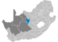 South Africa Districts showing Frances Baard.png 1,141 × 828; 31 KB
-
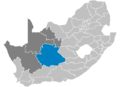 South Africa Districts showing Karoo.png 1,141 × 828; 31 KB
-
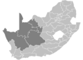
 South Africa Districts showing Kgalagadi.png 1,141 × 828; 31 KB
-
 South Africa Districts showing Namakwa.png 1,141 × 828; 31 KB
-
 South Africa Districts showing NC.png 1,141 × 828; 31 KB
-
 South Africa Districts showing Siyanda.png 1,141 × 828; 31 KB


.svg)
.svg)


.svg)
.svg)
.svg)
.svg)
.svg)
.svg)
.svg)
.svg)
.svg)
.svg)
.svg)
.svg)
.svg)
.svg)
.svg)
.svg)
.svg)
.svg)
.svg)
.svg)
.svg)
.svg)
.svg)
.svg)
.svg)
.svg)
.svg)
.svg)
.svg)
.svg)
.svg)
.svg)
.svg)


.svg)
.svg)


.svg)
.svg)