Category:Maps of Nohèdes
Jump to navigation
Jump to search
Wikimedia category | |||||
| Upload media | |||||
| Instance of | |||||
|---|---|---|---|---|---|
| Category combines topics | |||||
| Nohèdes | |||||
commune in Pyrénées-Orientales, France   | |||||
| Pronunciation audio | |||||
| Instance of | |||||
| Location | |||||
| Head of government |
| ||||
| Population |
| ||||
| Area |
| ||||
| official website | |||||
 | |||||
Media in category "Maps of Nohèdes"
The following 12 files are in this category, out of 12 total.
-
 66122-Nohèdes-argile.png 4,076 × 3,307; 6.22 MB
-
 66122-Nohèdes-Natura2000.png 5,846 × 4,133; 7.41 MB
-
 66122-Nohèdes-Routes-Hydro.png 3,507 × 2,480; 708 KB
-
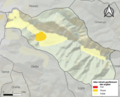
 66122-Nohèdes-Sols.png 3,270 × 2,598; 1.08 MB
-
 66122-Nohèdes-ZNIEFF1.png 3,057 × 2,480; 4.93 MB
-
 66122-Nohèdes-ZNIEFF2.png 3,519 × 2,480; 4.7 MB
-
 66122-Nohèdes-Zone inondable.png 4,677 × 3,307; 7.27 MB
-
 Localització de Noedes respecte del Conflent.svg 428 × 323; 239 KB
-
 Map commune FR insee code 66122.png 756 × 605; 47 KB
-
 Noedes el 1812.png 773 × 451; 709 KB
-
 Noedes en el Conflent.png 862 × 600; 57 KB
-
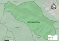
 Périmètre RNN Nohèdes rnn84.png 1,237 × 825; 547 KB


