Category:Maps of Niklashausen
Jump to navigation
Jump to search
Subcategories
This category has only the following subcategory.
H
Media in category "Maps of Niklashausen"
The following 5 files are in this category, out of 5 total.
-
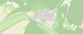 Lage Niklashausen.png 1,861 × 777; 1.07 MB
-

-

-
 Niklashausen mit Taubermühle um 1665.jpg 4,271 × 3,251; 752 KB
-
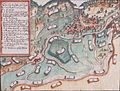
 Niklashausen und Gamburg um 1530.jpg 5,726 × 3,934; 624 KB

_(1)_Gemarkungen_H%C3%B6hefeld_(Wertheim)_und_Niklashausen_(Werbach)_1904.jpg)
_(cropped).jpg)

