<nowiki>Category:Maps of Niš; Kategori:Kartor över Niš; categoría de Wikimedia; 維基媒體分類; 维基媒体分类; categurìa 'e nu pruggette Wikimedia; categoría de Wikimedia; Викимедиина категорија; Vikimedya kategorisi; விக்கிமீடியப் பகுப்பு; kategori Wikimedia; Vikimédia ñemohenda; Wikimedia-categorie; विकिमिडिया श्रेणी; Wikimedia category; Wikimedia:Klassys; категория на Уикимедия; kategoria w projekcie Wikimedia; categorie în cadrul unui proiect Wikimedia; 維基媒體分類; หน้าหมวดหมู่วิกิมีเดีย; kategória projektov Wikimedia; Wikimedia-kategori; د ويکيمېډيا وېشنيزه; категорія проєкту Вікімедіа; kawan Wikimèdia; гурӯҳи Викимедиа; 维基媒体分类; Wikimedia-Kategorie; 위키미디어 분류; Wikimedia-bólkur; kategorio en Vikimedio; kategori Wikimedia; Wikimedia-Kategorie; विकिपीडिया:श्रेणी; উইকিমিডিয়া বিষয়শ্রেণী; page de catégorie de Wikimedia; kategori Wikimedia; kategorija na Wikimediji; Wikimedia proyektındağı törkem; 维基媒体分类; Wikimedia-Kategorie; категория в проекте Викимедиа; विकिपीडिया वर्ग; kategorija w projektach Wikimedije; thể loại Wikimedia; ردهٔ ویکیپدیا; Wikimedia projekta kategorija; Wikimedia-kategorie; категорија на Викимедији; катэгорыя ў праекце Вікімэдыя; kategorija na Wikimediji; categoria de um projeto da Wikimedia; 维基媒体分类; категорияд Ангилал; Wikimedia-kategori; Wikimedia-kategori; kategori Wikimédia; kategori Wikimedia; Wikimedia-Kategorie; катэгорыя ў праекце Вікімедыя; پۆلی ویکیمیدیا; Wikimedia category; تصنيف ويكيميديا; pajenn rummata eus Wikimedia; විකිමීඩියා ප්රභේද පිටුව; Wikimedia:ကဏ္ဍခွဲခြင်း; 維基媒體分類; Wikimedia категориясы; વિકિપીડિયા શ્રેણી; Wikimedia-categorie; Wikimediako kategoria; ვიკიპედია:კატეგორიზაცია; categoría de Wikimedia; Wikimedia-Kategorie; Wikimedia-Kategorie; tudalen categori Wikimedia; Vikipidiya:Shopni; Viciméid catagóir; Վիքիմեդիայի նախագծի կատեգորիա; Wikimedia-kategorie; Wîkîmediya:Kategorî; विकिमिडिया श्रेणी; ウィキメディアのカテゴリ; Wikimedia-Kategorie; ویکیمیڈیا زمرہ; تصنيف بتاع ويكيميديا; Wikimedia kategooria; דף קטגוריה; categoria Vicimediorum; 维基媒体分类; विकिमीडिया श्रेणी; 維基媒體分類; Wikimedia-kategoriija; гурӯҳ дар лоиҳаи Викимедиа; Wikimedia-categorie; Kategoriya ning Wikimedia; gurühi Vikimedia; categoria di un progetto Wikimedia; kategorie na projektech Wikimedia; Wikimedia category; Wikimedia-luokka; 維基媒體分類; Wikimédia-kategória; Викимедиа проектындагы төркем; Wikimedia:Ronnaghys; Викимедиа проектындагы төркем; ẹ̀ka Wikimedia; catigurìa di nu pruggettu Wikimedia; categoria de um projeto da Wikimedia; categoria Wikimedia; Wikimedia-kategori; tumbung Wikimedia; kategori e Wikimedias; kategorija Wikimedie; kategorya ng Wikimedia; Викимедиа категорияһы; categoria de Wikimedia; kategori Wikimedia; jamii ya Wikimedia; വിക്കിമീഡിയ വർഗ്ഗം; Wikimedia:Kategorija; kategori Wikimedia; Wikimedia-kategory; زمرو:وڪيپيڊيا زمرا بندي; Wikimedia-Kategorie; categoría de Wikimedia; kategoria ti Wikimedia; κατηγορία εγχειρημάτων Wikimedia; Wikimedia category</nowiki>
Subcategories
This category has only the following subcategory.


 2024 Niš local elections map.png 1,401 × 1,099; 44 KB
 Bombardment of Nis.png 2,204 × 1,317; 1.09 MB
 Bombardovanje Nisa.png 2,204 × 1,290; 1.63 MB
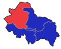 Crveni krst.png 800 × 640; 75 KB
 Mapa položaja Niš.svg 1,195 × 1,353; 1.81 MB
 Medijana.png 800 × 640; 75 KB
 Municipalities of Serbia Niš.png 1,565 × 1,988; 186 KB
 Nis - 40-43.jpg 3,689 × 4,990; 4.16 MB
 Nis 1878 sindjelicev trg.jpg 2,012 × 1,650; 373 KB
 Nis Municipalities.png 375 × 294; 35 KB
 Nis pos.png 400 × 471; 39 KB
 Niska banja.png 800 × 640; 76 KB
 Niška kotlina.png 573 × 434; 179 KB
 Palilula.png 800 × 640; 76 KB
 Pantelej.png 800 × 640; 75 KB
 Serbia Nis.jpg 400 × 565; 56 KB
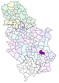 Serbia Niš.png 400 × 565; 24 KB
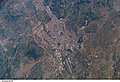 Space Shutle GradNis.jpg 3,032 × 2,064; 1.48 MB
 Vozdova ulica u Nisu.png 1,387 × 836; 355 KB
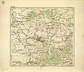 Ђенералштабна карта Србије-И 8, Ниш.jpg 2,794 × 2,400; 841 KB
 Ниш општине.jpg 1,308 × 1,045; 131 KB


