
Category:Maps of Newport News, Virginia
Media in category "Maps of Newport News, Virginia"
The following 16 files are in this category, out of 16 total.
-

-
 Admiralty Chart No 2843 Chesapeake Bay Entrance, Published 1914, Large Corrections 1961.jpg 16,477 × 11,330; 56.3 MB
-

-

-

-

-
-
 Map of Virginia highlighting Newport News City.svg 7,486 × 3,247; 223 KB
-
 Map showing Newport News city, Virginia.png 750 × 485; 36 KB
-

-
 Perspective map of Newport News, Va., county seat of Warwick County 1891. LOC 75696642.jpg 10,736 × 6,880; 19.84 MB
-
 Race and ethnicity 2010- Newport News (5559847663).png 3,009 × 3,009; 2.74 MB
-
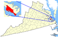
 VAMap-doton-NewportNews.PNG 296 × 130; 6 KB
-
 Virginia Senate District 1 (2011).png 3,487 × 1,524; 676 KB
-
 Virginia Senate District 2 (2011).png 3,507 × 1,534; 682 KB
-
 Virginia-peninsula.png 1,022 × 855; 147 KB
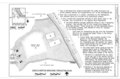
_-_Newport_News_City_-_Newport_News_-_ED_114-1_to_55_-_NARA_-_51435599.jpg)

.png)
.png)
.png)


.png)

.png)
.png)
