Category:Maps of Newport, Rhode Island
Jump to navigation
Jump to search
Wikimedia category | |||||
| Upload media | |||||
| Instance of | |||||
|---|---|---|---|---|---|
| Category combines topics | |||||
| Newport | |||||
city in and county seat of Newport County, Rhode Island, United States     | |||||
| Instance of | |||||
| Location | Newport County, Rhode Island | ||||
| Head of government |
| ||||
| Inception |
| ||||
| Population |
| ||||
| Area |
| ||||
| Elevation above sea level |
| ||||
| Different from | |||||
| official website | |||||
 | |||||
Subcategories
This category has only the following subcategory.
Media in category "Maps of Newport, Rhode Island"
The following 40 files are in this category, out of 40 total.
-
 Newport Tower location.jpg 1,008 × 1,224; 1.17 MB
-
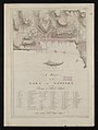
 1776 map Newport RhodeIsland byDesBarres BPL 12640.png 474 × 661; 320 KB
-
 1778 Rhode Island detail of map byKitchin BPL 14154.png 1,055 × 743; 1.56 MB
-
 1781 Newport Rhode Island detail of map byDelamarche BPL 12306.png 1,221 × 608; 1.07 MB
-

-
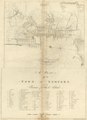
 A plan of the town of Newport in Rhode Island. LOC 74692104.jpg 4,685 × 4,390; 4.08 MB
-
-
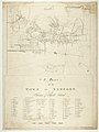 A plan of the town of Newport in the province of Rhode Island RMG K0282.jpg 958 × 1,280; 906 KB
-
 A plan of the town of Newport in the province of Rhode Island RMG K0284.jpg 997 × 1,280; 974 KB
-
 A plan of the town of Newport in the province of Rhode Island RMG K0285.jpg 959 × 1,280; 936 KB
-
 A plan of the town of Newport in the province of Rhode Island RMG K0286.jpg 927 × 1,280; 1.01 MB
-
 Admiralty Chart No 2892a Rhode Island State Narraganset Bay, Published 1862.jpg 12,505 × 8,835; 13.38 MB
-

-
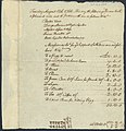 Caesar Lyndon's Sundry Account Book, 1766.jpg 1,309 × 1,350; 456 KB
-
 Easton Point map.JPG 287 × 287; 34 KB
-
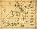
 EB9 Newport (Rhode Island) - plan.jpg 842 × 925; 396 KB
-
 Endeavour Bark wreckage sign.jpg 2,268 × 2,600; 1.88 MB
-
 Fort Hamilton, Rose Island, Newport, Newport County, RI HAER RI-58 (sheet 2 of 4).png 9,945 × 14,415; 4.93 MB
-
 Fort Hamilton, Rose Island, Newport, Newport County, RI HAER RI-58 (sheet 4 of 4).png 9,936 × 14,440; 7.67 MB
-
 FortGeorgeakaWolcott01.jpg 600 × 400; 112 KB
-
 GreysRaid.png 3,648 × 2,695; 20.75 MB
-
 Fort Hamilton, Rose Island, Newport, Newport County, RI HAER RI-58 (sheet 2 of 4).tif 9,945 × 14,415; 603 KB
-
 Fort Hamilton, Rose Island, Newport, Newport County, RI HAER RI-58 (sheet 3 of 4).tif 9,895 × 14,407; 781 KB
-
 Fort Hamilton, Rose Island, Newport, Newport County, RI HAER RI-58 (sheet 4 of 4).tif 9,936 × 14,440; 1.13 MB
-
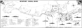
 Historic Newport Rhode Island 1878 map.jpg 2,541 × 2,082; 706 KB
-
 Improvement Newport Harbor, Rhode Island - NARA - 128215707.jpg 7,884 × 6,444; 2.25 MB
-
 Karte 8-1.jpg 1,900 × 2,631; 4.79 MB
-
 Map of US Naval Station Newport RI 1966.png 3,105 × 1,060; 628 KB
-
 New England - a handbook for travelers (1880) (14761804081).jpg 3,018 × 2,420; 893 KB
-
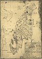
 Newport en Rhode Island 1780.jpg 3,214 × 4,353; 11.46 MB
-
 Newport RI lg.PNG 527 × 811; 7 KB
-
 Newport, RI locator map.svg 512 × 778; 70 KB
-

-
 Plan of the town and harbour of Newport on Rhode Island RMG F0389.tiff 6,164 × 5,821; 102.66 MB
-
-
 Rhode Island Municipalities Newport Highlighted.png 396 × 584; 33 KB
-

-
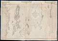
 The Atlantic Neptune, published for the use of the Royal Navy of Great Britain, LOC 75332515-7.tif 6,364 × 8,741; 159.15 MB
-
 The magazine of American history with notes and queries (1877) (14582714197).jpg 3,076 × 1,696; 738 KB
-
 The magazine of American history with notes and queries (1877) (14598318787).jpg 1,904 × 1,344; 387 KB


.jpg)


_(14776292982).jpg)


_-_plan.jpg)

.png)
.png)


_(14761804081).jpg)


_(14582714197).jpg)
_(14598318787).jpg)