Category:Maps of New Haven County, Connecticut
Jump to navigation
Jump to search
Wikimedia category | |||||
| Upload media | |||||
| Instance of | |||||
|---|---|---|---|---|---|
| Category combines topics | |||||
| New Haven County | |||||
county in Connecticut, United States   | |||||
| Instance of | |||||
| Named after | |||||
| Location |
| ||||
| Capital | |||||
| Inception |
| ||||
| Population |
| ||||
| Area |
| ||||
| Different from | |||||
 | |||||
Subcategories
This category has the following 3 subcategories, out of 3 total.
Media in category "Maps of New Haven County, Connecticut"
The following 84 files are in this category, out of 84 total.
-
 Ansonia CT lg.PNG 1,824 × 1,374; 110 KB
-
 AnsoniaCtLocatorMap.png 936 × 695; 165 KB
-
 Beacon Falls CT lg.PNG 1,824 × 1,374; 110 KB
-
 BeconFallsCtLocatorMap.png 936 × 695; 79 KB
-
 Bethany CT lg.PNG 1,824 × 1,374; 110 KB
-
 BethanyCtLocatorMap.png 936 × 695; 79 KB
-
 BranfordCtLocatorMap.png 936 × 695; 79 KB
-
 ChechireCtLocatorMap.png 936 × 695; 79 KB
-
 Cheshire CT lg.PNG 1,824 × 1,374; 110 KB
-
 Cheshire, Connecticut lg.png 1,668 × 1,214; 55 KB
-
 Cheshire, CT lg.png 1,668 × 1,214; 50 KB
-
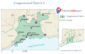
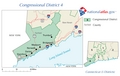 CT 4th Congressional District.png 640 × 405; 62 KB
-
 CT 5th Congressional District.png 655 × 405; 42 KB
-
 CtOrangeTownLocatorMap.png 936 × 695; 87 KB
-
 CtWestHavenLocatorMap.png 936 × 695; 79 KB
-
 Derby CT lg.PNG 1,824 × 1,374; 110 KB
-
 DerbyCtLocatorMap.png 936 × 695; 79 KB
-
 HamdenCtLocatorMap.png 936 × 695; 79 KB
-
 Madison CT lg.PNG 1,824 × 1,374; 110 KB
-
 MadisonCtLocatorMap.png 936 × 695; 79 KB
-
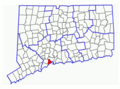
 Map of Connecticut highlighting New Haven County.svg 1,624 × 1,184; 10 KB
-
 Map of Wallingford.png 250 × 188; 32 KB
-
 Meriden CT lg.PNG 1,824 × 1,374; 110 KB
-
 MeridenCtLocatorMap.png 936 × 695; 79 KB
-
 Middlebury CT lg.PNG 1,824 × 1,374; 110 KB
-
 MiddleburyCtLocatorMap.png 936 × 695; 79 KB
-
 Milford CT lg.PNG 1,824 × 1,374; 110 KB
-
 MilfordCtAreaOutlineMap.png 359 × 481; 13 KB
-
 MilfordCtOutnlineMap.png 936 × 695; 79 KB
-
 N Branford CT lg.PNG 1,824 × 1,374; 110 KB
-
 Naugatuck CT lg.PNG 1,824 × 1,374; 110 KB
-
 Naugatuck-town.gif 575 × 425; 55 KB
-
 NaugatuckCtLocatorMap.png 936 × 695; 79 KB
-
 NBranfordCtLocatorMap.png 936 × 695; 79 KB
-

-

-

-

-

-

-

-

-

-
-

-

-

-

-

-

-

-

-
-

-
-

-

-

-
-

-

-

-
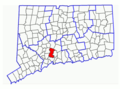
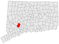
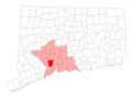
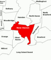 NewHavenAreaOutlineMap.png 515 × 609; 9 KB
-
 NewHavenCtOutlineMap.png 936 × 695; 79 KB
-
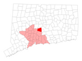
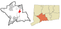
 NorthHavenCtLocatorMap.png 936 × 695; 160 KB
-
 Oxford CT lg.PNG 1,824 × 1,374; 110 KB
-
 Prospect CT lg.PNG 1,824 × 1,374; 110 KB
-
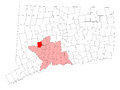
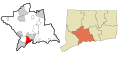
 ProspectCtLocatorMap.png 936 × 695; 166 KB
-
 Seymour CT lg.PNG 1,824 × 1,374; 110 KB
-
 SeymourCtLocatorMap.png 936 × 695; 79 KB
-
 Southbury CT lg.PNG 1,824 × 1,374; 110 KB
-
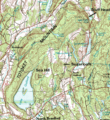 Totoket Mountain.gif 543 × 592; 183 KB
-
-
 US CT Map EastHaven.PNG 398 × 286; 13 KB
-
 US-CT-Guilford.png 450 × 336; 38 KB
-
 US-CT-Oxford.png 450 × 336; 38 KB
-
 US-CT-Southbury.png 450 × 336; 38 KB
-
 US-CT-Wolcott.png 450 × 336; 38 KB
-
 Wallingford CT lg.PNG 1,824 × 1,374; 110 KB
-
 US-CT-Wallingford.png 450 × 336; 38 KB
-
 Wolcott CT lg.PNG 1,824 × 1,374; 110 KB
-
 Woodbridge CT lg.PNG 1,824 × 1,374; 110 KB
-
 WoodbridgeCtLocatorMap.png 936 × 695; 79 KB
-
 Woodmont, connecticut map.gif 575 × 425; 35 KB


_Highlighted_0947515.svg)


