Category:Maps of Neukölln (district of Berlin)
Jump to navigation
Jump to search
Subcategories
This category has the following 5 subcategories, out of 5 total.
B
- Maps of Berlin-Britz (9 F)
- Maps of Berlin-Buckow (5 F)
G
- Maps of Berlin-Gropiusstadt (5 F)
N
- Maps of Berlin-Neukölln (6 F)
R
- Maps of Berlin-Rudow (7 F)
Media in category "Maps of Neukölln (district of Berlin)"
The following 9 files are in this category, out of 9 total.
-
 Ahwk neukölln 1.jpg 629 × 826; 55 KB
-
 Ahwk neukölln 2.jpg 629 × 826; 55 KB
-
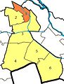
 Berlin Neukoelln Gropiusstadt.png 508 × 568; 45 KB
-
 Berlin Neukoelln Rudow.png 508 × 568; 46 KB
-
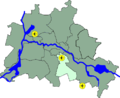
 Berlin neukoelln.png 800 × 643; 48 KB
-
 Berlin Neukoelln.png 508 × 568; 45 KB
-
 Bezirkskarte Neukölln 10k mit PLZ 2014-10-30.pdf 5,314 × 6,908; 24.23 MB
-
 Bezirkskarte Neukölln 20k 2013-10-31.pdf 2,656 × 3,447; 12.13 MB
-
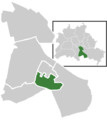
 Lage Bezirk Neukoelln in Berlin.png 484 × 395; 26 KB


