Category:Maps of National Historic Trails (United States)
Jump to navigation
Jump to search
Subcategories
This category has the following 6 subcategories, out of 6 total.
Media in category "Maps of National Historic Trails (United States)"
The following 23 files are in this category, out of 23 total.
-
CAJO-Basic-Trail-Map.jpg 630 × 850; 118 KB
-
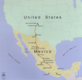
CaminoRealAdentro.png 698 × 682; 374 KB
-
Captain-John-Smith-Chesapeake-NHT-map.png 410 × 540; 61 KB
-
Iditarod Trail BLM map.jpg 759 × 576; 85 KB
-
Lewis and Clark National Historic Trail 2015.png 13,200 × 10,200; 975 KB
-
Lewis and Clark National Historic Trail.PNG 286 × 186; 27 KB
-
Nez Perce National Historic Trail Text.jpg 4,608 × 3,072; 1.73 MB
-
Nez Perce National Historic Trail.PNG 286 × 186; 27 KB
-
NPS california-trail-map.jpg 9,027 × 1,665; 2.71 MB
-
NPS california-trail-map.pdf 6,770 × 1,247; 8.28 MB
-
NPS lewis-and-clark-trail-map.gif 7,288 × 1,692; 1.17 MB
-
NPS lewis-and-clark-trail-map.pdf 7,037 × 1,268; 9.88 MB
-
NPS overmountain-victory-trail-map.jpg 3,364 × 4,422; 1.86 MB
-
NPS overmountain-victory-trail-map.pdf 2,522 × 3,316; 8.37 MB
-
NPS pony-express-trail-map.jpg 11,259 × 2,066; 3.31 MB
-
NPS pony-express-trail-map.pdf 6,754 × 1,239; 6.75 MB
-
NPS santa-fe-trail-map.jpg 7,511 × 1,702; 2.42 MB
-
NPS santa-fe-trail-map.pdf 5,633 × 1,277; 664 KB
-
NPS trail-of-tears-map.gif 4,686 × 2,310; 806 KB
-
NPS trail-of-tears-map.pdf 3,947 × 2,370; 2.07 MB


