Category:Maps of Nahuel Huapi Lake
Jump to navigation
Jump to search
Media in category "Maps of Nahuel Huapi Lake"
The following 12 files are in this category, out of 12 total.
-
 ETH-BIB-Karte Llanquihué, Todos Santo, Nahuel Huapi-Dia 247-12339.tif 3,876 × 2,700; 10.07 MB
-
 ETH-BIB-Karte Nahuel Huapi, Angostura-Huemul pto Blest Bariloche-Dia 247-11827.tif 3,675 × 2,645; 27.95 MB
-
 ETH-BIB-Karte Nahuel Huapi, Ecke Huemul, Pto Moreno Bariloche-Dia 247-11824-1.tif 3,528 × 2,875; 9.79 MB
-
 ETH-BIB-Karte Nahuel Huapi, Elia Hucmul, Bahia Lopez Bariloche-Dia 247-11824.tif 3,628 × 2,509; 26.17 MB
-
 ETH-BIB-Karte Nahuel Huapi, Mitte-Dia 247-11827-1.tif 3,510 × 2,863; 28.9 MB
-
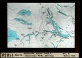
 ETH-BIB-Karte Nahuel Huapi, Übersicht, Parque Nacional N-S-Dia 247-11813.tif 2,951 × 3,340; 28.33 MB
-
 ETH-BIB-Karte Puerto Blest, Bahia Lopez, Laguna Frias, Lago Frey-Dia 247-11826.tif 3,622 × 2,657; 27.66 MB
-
 ETH-BIB-Karte, Lacar-Nahuel Huapi, Mascardi-Dia 247-15365.tif 2,994 × 3,372; 9.72 MB
-
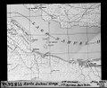
 ETH-BIB-Karte, Übersicht Espejo - Traful - Ensenada - Peulla - Bariloche-Dia 247-11830.tif 3,728 × 2,633; 28.2 MB
-
 ETH-BIB-Nahuel Huapi, Tiefenmessung, Karte 1898-Dia 247-Z-00264.tif 3,615 × 2,914; 30.28 MB
-
 ETH-BIB-Nahuel Huapi, Übersicht (mit Zürichsee)-Dia 247-11832.tif 3,110 × 3,357; 29.98 MB
-
 ETH-BIB-Nahuel Huapi, Übersicht-Dia 247-11832-1.tif 3,016 × 3,405; 29.5 MB