Category:Maps of Mykolaiv
Jump to navigation
Jump to search
Wikimedia category | |||||
| Upload media | |||||
| Instance of | |||||
|---|---|---|---|---|---|
| Category combines topics | |||||
| Mykolaiv | |||||
capital city of Mykolaiv Oblast in southern Ukraine | |||||
| Pronunciation audio | |||||
| Instance of |
| ||||
| Location |
| ||||
| Located in or next to body of water | |||||
| Head of government |
| ||||
| Inception |
| ||||
| Population |
| ||||
| Area |
| ||||
| Elevation above sea level |
| ||||
| Different from | |||||
| official website | |||||
 | |||||
Subcategories
This category has the following 2 subcategories, out of 2 total.
Media in category "Maps of Mykolaiv"
The following 24 files are in this category, out of 24 total.
-
Ile de Bérézen - btv1b532292973.jpg 7,168 × 9,428; 5.74 MB
-
Map of Mykolaiv castle.jpg 960 × 923; 288 KB
-
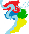
Map of Mykolaiv districts.png 423 × 494; 24 KB
-
Mykolaiv location map.png 973 × 1,287; 1.23 MB
-
Mykolaiv MCA former mainland core map.png 861 × 691; 73 KB
-
Mykolajiw-Ukraine-Map.png 1,200 × 798; 80 KB
-
Mykolayiv-Myk-Raion.png 390 × 318; 64 KB
-
Nikolajew-Skizze 1952b.jpg 902 × 1,016; 285 KB
-
Nmp.gif 185 × 274; 10 KB
-
Plan de l'isle de Berezen - btv1b53234513q.jpg 6,582 × 7,456; 4.09 MB
-
Кордони Фаброва Дача.jpg 900 × 699; 550 KB
-
План Николаева 1789.jpg 2,144 × 1,648; 461 KB
-
План Николаева 1795.jpg 2,256 × 1,808; 560 KB
-
План Николаева 1825.jpg 2,160 × 2,013; 430 KB
-
План Николаева 1855.jpg 3,165 × 3,020; 1.44 MB
-
План Николаева 1869.jpg 3,162 × 4,723; 16.74 MB
-
План Николаева 1882.jpg 4,662 × 3,162; 18.64 MB
-
План Николаева 1898.jpg 4,723 × 3,162; 17.63 MB
-
План Николаева 1908.JPG 2,816 × 2,112; 1.47 MB
-
План Николаева 1910.jpg 2,181 × 1,563; 812 KB
-
План Николаева 1928.jpg 2,200 × 1,460; 1.15 MB
-
План Николаева 1931 (электрохозяйство).jpg 2,658 × 1,893; 616 KB
-
План Николаева 1931.jpg 2,668 × 1,916; 607 KB
-
План Николаева 1954.jpg 2,007 × 1,851; 3.77 MB


