Category:Maps of Mulhouse Alsace Agglomération
Jump to navigation
Jump to search
Media in category "Maps of Mulhouse Alsace Agglomération"
The following 6 files are in this category, out of 6 total.
-
68015-Baldersheim-Sols.png 3,270 × 2,598; 2.8 MB
-
68056-Brunstatt-Didenheim-Sols.png 3,270 × 2,598; 4.45 MB
-
Localisation EPCI Mulhouse Alsace Agglomération dans le Haut-Rhin, France.svg 1,000 × 1,702; 135 KB
-
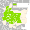
Unité urbaine de Mulhouse en 2020, selon source INSEE.svg 556 × 540; 146 KB
-
ZFE-Mulhouse-Agglomération.svg 556 × 540; 145 KB


