Category:Maps of Montmotier
Jump to navigation
Jump to search
Wikimedia category | |||||
| Upload media | |||||
| Instance of | |||||
|---|---|---|---|---|---|
| Category combines topics | |||||
| Montmotier | |||||
commune in Vosges, France    | |||||
| Instance of | |||||
| Location |
| ||||
| Population |
| ||||
| Area |
| ||||
| official website | |||||
 | |||||
Media in category "Maps of Montmotier"
This category contains only the following file.
-
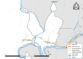 88311-Montmotier-Routes-Hydro.png 3,507 × 2,480; 1.27 MB
