Category:Maps of Montcourt-Fromonville
Jump to navigation
Jump to search
Wikimedia category | |||||
| Upload media | |||||
| Instance of | |||||
|---|---|---|---|---|---|
| Category combines topics | |||||
| Montcourt-Fromonville | |||||
commune in Seine-et-Marne, France  .svg)  | |||||
| Instance of | |||||
| Location | |||||
| Located in or next to body of water | |||||
| Head of government |
| ||||
| Population |
| ||||
| Area |
| ||||
| Elevation above sea level |
| ||||
| official website | |||||
 | |||||
Subcategories
This category has only the following subcategory.
Media in category "Maps of Montcourt-Fromonville"
The following 11 files are in this category, out of 11 total.
-
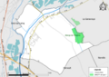
 77302-Montcourt-Fromonville - Localisation.png 2,500 × 2,480; 1.42 MB
-
 77302-Montcourt-Fromonville - Relief-PlanIgn.png 7,015 × 4,960; 7.83 MB
-
 77302-Montcourt-Fromonville-Cadastre.png 7,015 × 4,960; 6.66 MB
-
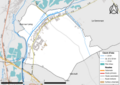 77302-Montcourt-Fromonville-Hydro.png 7,015 × 4,960; 4.53 MB
-
 77302-Montcourt-Fromonville-Natura 2000.png 7,015 × 4,960; 3.22 MB
-
 77302-Montcourt-Fromonville-Orthophoto.png 7,015 × 4,960; 4.86 MB
-
 77302-Montcourt-Fromonville-Sols.png 7,015 × 4,960; 3.57 MB
-
 77302-Montcourt-Fromonville-ZNIEFF1.png 7,015 × 4,960; 3.16 MB
-
 77302-Montcourt-Fromonville-ZNIEFF2.png 7,015 × 4,960; 3.27 MB
-

-
 Map commune FR insee code 77302.png 756 × 605; 36 KB


.jpg)