Category:Maps of Montauban
Jump to navigation
Jump to search
Wikimedia category | |||||
| Upload media | |||||
| Instance of | |||||
|---|---|---|---|---|---|
| Category combines topics | |||||
| Montauban | |||||
commune in Tarn-et-Garonne, France | |||||
| Instance of | |||||
| Location |
| ||||
| Located in or next to body of water | |||||
| Significant event |
| ||||
| Population |
| ||||
| Area |
| ||||
| Elevation above sea level |
| ||||
| official website | |||||
 | |||||
Subcategories
This category has only the following subcategory.
G
Media in category "Maps of Montauban"
The following 24 files are in this category, out of 24 total.
-
82 TARN-ET-GARONNE carte grille communale densite INSEE.png 3,507 × 2,480; 2.62 MB
-
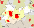
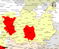
82-AAV2020-Montauban.png 3,519 × 2,930; 2.02 MB
-
82-Montauban-AAV2020.png 3,519 × 2,930; 1.9 MB
-
82121-Montauban-argile.jpg 3,057 × 2,480; 1.1 MB
-
82121-Montauban-Natura2000.png 5,846 × 4,133; 19.36 MB
-
82121-Montauban-Routes-Hydro.png 3,507 × 2,480; 7.17 MB
-
82121-Montauban-Sols.png 3,270 × 2,598; 7.13 MB
-
82121-Montauban-ZNIEFF1.png 3,057 × 2,480; 9.01 MB
-
82121-Montauban-ZNIEFF2.png 3,519 × 2,480; 9.94 MB
-
Carte du diocèse de Montauban.jpg 9,984 × 7,280; 37.54 MB
-
Diocèse Montauban 1789.svg 2,000 × 1,922; 801 KB
-
Kaart wijken montauban.jpg 605 × 538; 123 KB
-
Map commune FR insee code 82121.png 756 × 605; 149 KB
-
Montauban 1661 Zeiller 15231.jpg 3,932 × 2,491; 6.59 MB
-
Montauban OSM 01.png 580 × 713; 294 KB
-
Montauban OSM 02.png 580 × 713; 487 KB
-
Montauban Toulouse OpenStreetMap.png 510 × 744; 654 KB
-
Montauban-Géolocalisation.svg 1,313 × 975; 10.86 MB
-
PlandeMtb.jpg 400 × 308; 40 KB
-
Remparts de Montauban en 1621.svg 744 × 1,052; 295 KB
-
Remparts mtb.png 2,480 × 3,507; 1.09 MB
-
Rempartswiki.jpg 2,480 × 3,507; 585 KB
-
Siege of Montauban 1621 Merian 1646.jpg 1,200 × 882; 228 KB
-
Urbanisation de Montauban.png 3,507 × 2,480; 898 KB


