Category:Maps of Mijnsheerenland
Jump to navigation
Jump to search
Wikimedia category | |||||
| Upload media | |||||
| Instance of | |||||
|---|---|---|---|---|---|
| Category combines topics | |||||
| Mijnsheerenland | |||||
farm village in the Netherlands    | |||||
| Instance of | |||||
| Location |
| ||||
| Located in or next to body of water | |||||
| Population |
| ||||
 | |||||
Media in category "Maps of Mijnsheerenland"
The following 10 files are in this category, out of 10 total.
-
 Gemeente Puttershoek 1867.jpg 1,200 × 1,038; 272 KB
-
 LocatieMijnsheerenland.png 280 × 130; 10 KB
-

-

-

-

-

-

-
 Map - NL - Binnenmaas - Wijk 01 Mijnsheerenland.svg 625 × 575; 11 KB
-
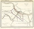
 Mijnsheerenland, Gemeenteatlas van Nederland.jpg 2,638 × 2,104; 1.16 MB


.svg)


