Category:Maps of Midden-Drenthe
Jump to navigation
Jump to search
Wikimedia category | |||||
| Upload media | |||||
| Instance of | |||||
|---|---|---|---|---|---|
| Category combines topics | |||||
| Midden-Drenthe | |||||
municipality of the Netherlands    .svg) | |||||
| Pronunciation audio | |||||
| Instance of |
| ||||
| Location | Drenthe, Netherlands | ||||
| Headquarters location | |||||
| Inception |
| ||||
| Population |
| ||||
| Area |
| ||||
| Elevation above sea level |
| ||||
| official website | |||||
 | |||||
Subcategories
This category has only the following subcategory.
Media in category "Maps of Midden-Drenthe"
The following 35 files are in this category, out of 35 total.
-
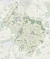
 2013-MiddenDrenthe.jpg 4,335 × 5,050; 10.68 MB
-
 BAG woonplaatsen - Gemeente Midden-Drenthe.png 2,419 × 2,419; 1.44 MB
-
 Gem-MiddenDrenthe-2014Q1.jpg 8,352 × 9,993; 28.99 MB
-
 Gem-MiddenDrenthe-OpenTopo.jpg 8,547 × 10,161; 9.07 MB
-
 Map - NL - Midden-Drenthe (2009).svg 625 × 575; 2.21 MB
-
 Map Bovensmilde school 1977.png 822 × 715; 135 KB
-
 Map NL - Midden-Drenthe - Balinge.png 800 × 600; 17 KB
-
 Map NL - Midden-Drenthe - Beilen.png 800 × 600; 17 KB
-
 Map NL - Midden-Drenthe - Bovensmilde.png 800 × 600; 16 KB
-
 Map NL - Midden-Drenthe - Brunsting.png 800 × 600; 17 KB
-
 Map NL - Midden-Drenthe - Bruntinge.png 800 × 600; 16 KB
-
 Map NL - Midden-Drenthe - Drijber.png 800 × 600; 16 KB
-
 Map NL - Midden-Drenthe - Elp.png 800 × 600; 17 KB
-
 Map NL - Midden-Drenthe - Eursinge.png 800 × 600; 17 KB
-
 Map NL - Midden-Drenthe - Garminge.png 800 × 600; 17 KB
-
 Map NL - Midden-Drenthe - Hijken.png 800 × 600; 17 KB
-
 Map NL - Midden-Drenthe - Hijkersmilde.png 800 × 600; 16 KB
-
 Map NL - Midden-Drenthe - Holthe.png 800 × 600; 17 KB
-
 Map NL - Midden-Drenthe - Hoogersmilde.png 800 × 600; 17 KB
-
 Map NL - Midden-Drenthe - Hooghalen.png 800 × 600; 16 KB
-
 Map NL - Midden-Drenthe - Laaghalen.png 800 × 600; 17 KB
-
 Map NL - Midden-Drenthe - Laaghalerveen.png 800 × 600; 16 KB
-
 Map NL - Midden-Drenthe - Mantinge.png 800 × 600; 17 KB
-
 Map NL - Midden-Drenthe - Nieuw-Balinge.png 800 × 600; 16 KB
-
 Map NL - Midden-Drenthe - Oranje.png 800 × 600; 17 KB
-
 Map NL - Midden-Drenthe - Orvelte.png 800 × 600; 16 KB
-
 Map NL - Midden-Drenthe - Smilde Municipality.PNG 800 × 600; 40 KB
-
 Map NL - Midden-Drenthe - Smilde.png 800 × 600; 17 KB
-
 Map NL - Midden-Drenthe - Spier.png 800 × 600; 16 KB
-
 Map NL - Midden-Drenthe - Westerbork.png 800 × 600; 17 KB
-
 Map NL - Midden-Drenthe - Wijster.png 800 × 600; 16 KB
-
 Map NL - Midden-Drenthe - Witteveen.png 800 × 600; 16 KB
-
 Map NL - Midden-Drenthe - Zuidveld.png 800 × 600; 17 KB
-
 Map NL - Midden-Drenthe - Zwiggelte.png 800 × 600; 16 KB
-
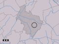
 NL - locator map municipality code GM1731 (2016).png 2,125 × 1,417; 446 KB


.svg)


.png)