Category:Maps of Microregions in the Czech Republic
Jump to navigation
Jump to search
Media in category "Maps of Microregions in the Czech Republic"
The following 12 files are in this category, out of 12 total.
-
 Dobrovolný svazek obcí 2002 TR map.svg 2,700 × 2,000; 630 KB
-
 HORÁCKO - ekologický region TR map.svg 2,700 × 2,000; 633 KB
-
 Jemnický mikroregion TR map.svg 2,700 × 2,000; 654 KB
-
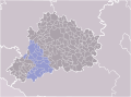
 Mikroregion Chvojnice TR map.svg 2,700 × 2,000; 630 KB
-
 Mikroregion Hrotovicko TR map.svg 2,700 × 2,000; 631 KB
-
 Mikroregion Náměštsko TR map.svg 2,700 × 2,000; 631 KB
-
 Mikroregion obcí Povodí Stařečského Potoka TR map.svg 2,700 × 2,000; 631 KB
-
 Mikroregion Podhůří Mařenky TR map.svg 2,700 × 2,000; 631 KB
-
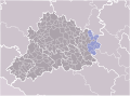
 Mikroregion Třebíčsko TR map.svg 2,700 × 2,000; 631 KB
-
 Mikroregion Černé Lesy TR map.svg 2,700 × 2,000; 645 KB
-
 Moravskobudějovický mikroregion TR map.svg 2,700 × 2,000; 631 KB
-
 Rokytná - ekologický mikroregion TR map.svg 2,700 × 2,000; 631 KB


