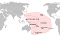
Category:Maps of Micronesia
Jump to navigation
Jump to search
Wikimedia category | |||||
| Upload media | |||||
| Instance of | |||||
|---|---|---|---|---|---|
| Category combines topics | |||||
| Micronesia | |||||
subregion of Oceania  | |||||
| Pronunciation audio | |||||
| Instance of | |||||
| Part of | |||||
| Location | Pacific Ocean, international waters | ||||
| Has part(s) | |||||
| Different from | |||||
 | |||||
Subcategories
This category has the following 9 subcategories, out of 9 total.
Pages in category "Maps of Micronesia"
This category contains only the following page.
Media in category "Maps of Micronesia"
The following 59 files are in this category, out of 59 total.
-
 114 karolinen-marshall-marianen-und-palau-inseln (1905).png 1,763 × 1,154; 1.33 MB
-
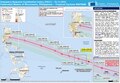 20150331 TC MAYSAK.pdf 1,625 × 1,125; 602 KB
-
 20150401 TC MAYSAK.pdf 1,625 × 1,125; 1.24 MB
-
 Atoll research bulletin (1956) (20319743826).jpg 3,024 × 2,460; 1.1 MB
-
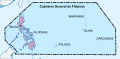 Capitanía general de Filipinas.svg 494 × 243; 200 KB
-
 Carte micronesie.png 1,012 × 628; 65 KB
-
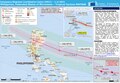
 ECDM 20141203 HAGUPIT.pdf 1,625 × 1,125; 898 KB
-
 ECDM 20150330 TC MAYSAK.pdf 1,625 × 1,125; 712 KB
-
 ECDM 20150402 TC MAYSAK v01.pdf 1,625 × 1,125; 867 KB
-
 ECDM 20150506 TC NOUL.pdf 1,625 × 1,125; 683 KB
-
 ECDM 20151119 World SevereWeather.pdf 1,625 × 1,125; 581 KB
-
 ECDM 20161222 TC NOCK-TEN v2.pdf 1,625 × 1,125; 722 KB
-
 Federated States of Micronesia - DPLA - 4b47c9a00a598d56f8b53e60392005ee.jpg 3,270 × 2,556; 1.05 MB
-
 Flag map of Micronesia (Main Island).png 757 × 770; 75 KB
-
 Flag map of the Federated States of Micronesia.png 900 × 350; 5 KB
-
 FLII Micronesia.png 1,024 × 712; 65 KB
-
 Imperio español en Asia y Oceanía.png 300 × 323; 25 KB
-
 Islas Marianas Palaos y Carolinas.JPG 902 × 489; 184 KB
-
 Languages of Micronesia.en.svg 1,630 × 1,203; 4.66 MB
-
 Map of Germany's western Pacific colonies as of 1910 (map0005325727).jpg 3,000 × 2,073; 5.97 MB
-
 Map of Micronesia Oceania ww.png 500 × 500; 10 KB
-
 Map of Micronesia Oceania.png 500 × 500; 11 KB
-
 MAP Philippine sea.jpg 499 × 383; 85 KB
-
 Mapa Micronesia.png 952 × 796; 39 KB
-
 Micronesia DNI Solar-resource-map GlobalSolarAtlas World-Bank-Esmap-Solargis.png 2,598 × 1,596; 724 KB
-
 Micronesia GHI Solar-resource-map GlobalSolarAtlas World-Bank-Esmap-Solargis.png 2,598 × 1,596; 702 KB
-
 Micronesia map hr.svg 850 × 400; 1.47 MB
-
 Micronesia map.gif 634 × 324; 25 KB
-
 Micronesia Population Density, 2000 (6172437826).jpg 2,396 × 3,161; 578 KB
-

-
 Micronesia-large.png 1,745 × 803; 434 KB
-
 Micronesia.png 386 × 298; 36 KB
-
 Micronesian Cultural Area.png 500 × 500; 94 KB
-
 Micronesian languages.en.svg 1,583 × 912; 4.67 MB
-
 Micronesian languages.fr.svg 1,583 × 912; 4.44 MB
-
 Nukuoro map.png 1,240 × 1,378; 6.53 MB
-
 Nukuoro North map.jpg 1,240 × 902; 278 KB
-
 Nukuoro South map.jpg 1,240 × 902; 178 KB
-
 Oceania UN Geoscheme - Map of Micronesia.svg 900 × 520; 520 KB
-
 Pacific Culture Areas (Philippines+Vanuatu Correction).svg 1,024 × 720; 558 KB
-
 Pacific Culture Areas AR.svg 1,024 × 720; 709 KB
-
 Pacific Culture Areas-ar.png 799 × 520; 211 KB
-
 Pacific Culture Areas-cs.png 872 × 567; 190 KB
-
 Pacific Culture Areas-de incl. Queensland and Peru.png 1,271 × 778; 306 KB
-
 Pacific Culture Areas-de incl. Queensland.png 1,731 × 1,125; 671 KB
-
 Pacific Culture Areas-de.png 872 × 567; 75 KB
-
 Pacific Culture Areas-eo.png 872 × 567; 186 KB
-
 Pacific Culture Areas-es.svg 1,278 × 700; 1.36 MB
-
 Pacific Culture Areas.jpg 872 × 567; 112 KB
-
 Pacific Culture Areas.png 1,396 × 908; 666 KB
-
 Pacific Culture Areas.svg 1,024 × 720; 862 KB
-
 Pacific Ocean laea Oceanian countries map.jpg 1,165 × 1,070; 542 KB
-
 Pacific Region Base Map.png 1,335 × 876; 303 KB
-
 PAT - Micronesia.gif 2,050 × 1,550; 146 KB
-
 Ps-map.gif 330 × 353; 10 KB
-
 Rm-map.png 330 × 355; 7 KB
-
 Spanish Provinces in the Pacific.jpg 411 × 250; 14 KB
-
 Spanish Provinces in the Pacific.png 411 × 250; 35 KB
-
 Txu-pclmaps-oclc-22834566 k-14d.jpg 9,185 × 6,752; 7.03 MB
.png)
_(20319743826).jpg)


.png)


.jpg)


.jpg)


.svg)


