Category:Maps of Meusnes (Loir-et-Cher)
Jump to navigation
Jump to search
Subcategories
This category has only the following subcategory.
Media in category "Maps of Meusnes (Loir-et-Cher)"
The following 4 files are in this category, out of 4 total.
-
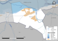
 41139-Meusnes-Natura2000-SIC.png 3,507 × 2,480; 1.35 MB
-
 41139-Meusnes-Natura2000-ZPS.png 3,507 × 2,480; 1.32 MB
-
 41139-Meusnes-Zone inondable.png 3,507 × 2,480; 907 KB
-
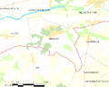 Map commune FR insee code 41139.png 756 × 605; 54 KB


