Category:Maps of Merthyr Tydfil County Borough
Jump to navigation
Jump to search
Wikimedia category | |||||
| Upload media | |||||
| Instance of | |||||
|---|---|---|---|---|---|
| Category combines topics | |||||
| Merthyr Tydfil | |||||
principal area in south-east Wales, United Kingdom   | |||||
| Instance of | |||||
| Location | Wales | ||||
| Capital | |||||
| Population |
| ||||
| Area |
| ||||
| Elevation above sea level |
| ||||
| Replaces | |||||
| official website | |||||
 | |||||
Subcategories
This category has only the following subcategory.
Media in category "Maps of Merthyr Tydfil County Borough"
The following 17 files are in this category, out of 17 total.
-
 2024 Wales Merthyr Tydfil Constituencies map.svg 512 × 688; 4 KB
-
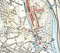
 Internal layout of the Pit.jpg 960 × 779; 77 KB
-
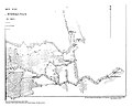
 Map of Abercanaid.jpg 1,000 × 872; 474 KB
-
 Map of Merthyr Tydfil communities (Welsh labels).svg 942 × 1,266; 238 KB
-
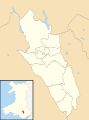
 Merthyr Tydfil County Borough UK ward locator map.png 715 × 990; 127 KB
-
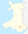
 Merthyr Tydfil in Wales.svg 1,047 × 1,252; 395 KB
-
 Merthyr Tydfil UK community map (blank).svg 942 × 1,266; 283 KB
-
 Merthyr Tydfil UK location map.svg 942 × 1,266; 380 KB
-
 Merthyr Tydfil UK map.svg 942 × 1,266; 222 KB
-
 Merthyr Tydfil UK relief location map.jpg 2,002 × 2,690; 457 KB
-
 Merthyr Tydfil UK ward map (blank).svg 942 × 1,266; 282 KB
-
 Ordnance Survey 1-250000 - SO.jpg 4,000 × 4,000; 9.7 MB
-
 South Wales 2.png 400 × 497; 57 KB
-
 Wales Merthyr Tydfil locator map.svg 1,047 × 1,251; 145 KB
-
 Wales Merthyr Tydfil.png 335 × 431; 7 KB
-
 Wales Merthyr Tydfil.svg 512 × 612; 277 KB
-
 WalesMerthyrTydfil.png 200 × 225; 22 KB


.svg)


.svg)
.svg)