Category:Maps of Mengjiang
Jump to navigation
Jump to search
Media in category "Maps of Mengjiang"
The following 13 files are in this category, out of 13 total.
-
Administrative map of the United Mongol Autonomous Government.png 3,000 × 1,800; 586 KB
-
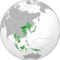
Japanese China.svg 600 × 600; 649 KB
-
JapanoccupationMengjiang1938.jpg 258 × 201; 50 KB
-
Manchukuo, Mengjiang and Nanjing in World War 2.png 1,406 × 983; 276 KB
-
Map of Reformed, Provisional Gov of ROC and Mengjiang - zh-hant.svg 217 × 277; 256 KB
-
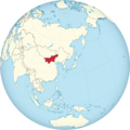
Mengjiang Globe.png 998 × 999; 546 KB
-
Mengjiang map 1939-es.svg 3,477 × 2,379; 2.2 MB
-
Mengjiang map 1939.svg 634 × 387; 2.23 MB
-
Mengjiang, North Shanxi, South Chahar Map - Circa 1937-1939.png 3,085 × 2,091; 7.18 MB
-
Mengjiang.png 599 × 599; 147 KB
-
The location of Mengjiang (as done in glorious mspaint).PNG 291 × 227; 26 KB


