Category:Maps of Menameradiel
Jump to navigation
Jump to search
Subcategories
This category has only the following subcategory.
Media in category "Maps of Menameradiel"
The following 22 files are in this category, out of 22 total.
-
 2013-Menaldumadeel.jpg 2,042 × 2,021; 2.37 MB
-
 BAG woonplaatsen - Gemeente Menameradiel.png 2,419 × 2,419; 442 KB
-
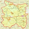
 Gem-Menaldumadeel-2014Q1.jpg 3,950 × 3,812; 6.07 MB
-
 Gem-Menaldumadeel-OpenTopo.jpg 4,508 × 4,573; 3.13 MB
-
 Map - NL - Menaldumadeel (2009).svg 625 × 575; 1.43 MB
-
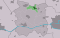
 Map NL Menameradiel Berltsum.png 800 × 500; 43 KB
-
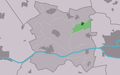
 Map NL Menameradiel Bitgum.png 800 × 500; 43 KB
-
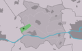
 Map NL Menameradiel Bitgummole.png 800 × 500; 42 KB
-
 Map NL Menameradiel Blessum.png 800 × 500; 42 KB
-
 Map NL Menameradiel Boksum.png 800 × 500; 42 KB
-
 Map NL Menameradiel Deinum.png 800 × 500; 43 KB
-
 Map NL Menameradiel Dronryp.png 800 × 500; 43 KB
-
 Map NL Menameradiel Ingelum.png 800 × 500; 42 KB
-
 Map NL Menameradiel Marsum.png 800 × 500; 43 KB
-
 Map NL Menameradiel Menaam.png 800 × 500; 43 KB
-
 Map NL Menameradiel Skingen.png 800 × 500; 43 KB
-
 Map NL Menameradiel Slappeterp.png 800 × 500; 43 KB
-
 Map NL Menameradiel Wier.png 800 × 500; 42 KB
-
 Menaldumadeel 5.68097E 53.19911N.jpg 1,280 × 958; 186 KB
-

-

-


.svg)


_kaartboek_Ruud_van_Juckema_1626_in_Rijksarchief_Leeuwarden_-_Menaldum_-_20152979_-_RCE.jpg)
_kaartboek_Ruud_van_Juckema_1626_in_Rijksarchief_Leeuwarden_-_Menaldum_-_20152980_-_RCE.jpg)
_kaartboek_Ruud_van_Juckema_1626_in_Rijksarchief_Leeuwarden_-_Menaldum_-_20152981_-_RCE.jpg)