Category:Maps of Mastbos
Jump to navigation
Jump to search
Nederlands: Afbeeldingen van kaarten van het Mastbos ten zuiden van Breda in de provincie Noord-Brabant in het zuiden van Nederland
Media in category "Maps of Mastbos"
The following 7 files are in this category, out of 7 total.
-
 Informatiebord DSCF2341.JPG 2,112 × 2,816; 2.57 MB
-
 Informatiebord DSCF2343.JPG 2,816 × 2,112; 2.65 MB
-
 Informatiebord Mastbos DSCF5767.JPG 2,112 × 2,816; 2.82 MB
-
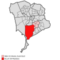 Map - NL - Breda - Wijk 03 Breda Zuid-Oost - Buurt 09 Mastbos.svg 375 × 375; 45 KB
-
 Tramlijn Breda - Mastbosch.png 1,516 × 1,064; 2.76 MB
-
 Tramlijn Ginneken - Mastbosch.png 1,475 × 997; 926 KB
-
 Vierkant van Maurits Mastbos.png 888 × 915; 621 KB


