Category:Maps of Manchukuo
Appearance
Wikimedia category | |||||
| Upload media | |||||
| Instance of | |||||
|---|---|---|---|---|---|
| Category combines topics | |||||
| Manchukuo | |||||
Japanese puppet state in Manchuria (1932–1945) | |||||
| Instance of | |||||
| Named after | |||||
| Capital | |||||
| Basic form of government |
| ||||
| Legislative body | |||||
| Executive body | |||||
| Official language | |||||
| Anthem | |||||
| Currency |
| ||||
| Head of state | |||||
| Inception |
| ||||
| Dissolved, abolished or demolished date |
| ||||
| Area |
| ||||
| Replaces |
| ||||
| Replaced by |
| ||||
 | |||||
Subcategories
This category has the following 3 subcategories, out of 3 total.
F
- Flag maps of Manchukuo (2 F)
S
Media in category "Maps of Manchukuo"
The following 68 files are in this category, out of 68 total.
-
1922 Map of the Far Eastern Republic.jpg 2,400 × 1,474; 1.26 MB
-
AdminChina1935.jpg 2,509 × 1,925; 1.84 MB
-
AdminMan.-Go1935.jpg 722 × 734; 303 KB
-
Andong and Shingishu map circa 1930.PNG 930 × 1,096; 764 KB
-
China 1936.png 120 × 131; 13 KB
-
China-Manchukuo-map (tr).svg 424 × 302; 313 KB
-
China-Manchukuo-map mk.svg 424 × 302; 383 KB
-
China-Manchukuo-map ru.svg 424 × 302; 281 KB
-
China-Manchukuo-map vi.svg 424 × 302; 281 KB
-
China-Manchukuo-map zh.svg 1,024 × 729; 175 KB
-
China-Manchukuo-map-2.svg 534 × 400; 344 KB
-
China-Manchukuo-map-es.svg 1,262 × 900; 600 KB
-
China-Manchukuo-map-fr.png 1,000 × 749; 201 KB
-
China-Manchukuo-map.png 635 × 325; 83 KB
-
China-Manchukuo-map.svg 424 × 302; 281 KB
-
Coloured map of Manchuria.jpg 1,489 × 2,347; 1.36 MB
-
Greater Asian Co-prosperity sphere.png 1,000 × 1,000; 263 KB
-
Japanese China.svg 600 × 600; 649 KB
-
JapanoccupationMengjiang1938.jpg 258 × 201; 50 KB
-
Jinzhou Map (1938).svg 400 × 225; 230 KB
-
Manchouko provinces (1937) in belarusian.png 720 × 803; 197 KB
-
Manchu State.png 998 × 999; 264 KB
-
Manchukuo in Empire of Japan.svg 600 × 600; 1.17 MB
-
Manchukuo locator map.svg 1,260 × 1,003; 2.66 MB
-
Manchukuo map 1939-es.svg 634 × 387; 1.32 MB
-
Manchukuo map 1939.svg 634 × 387; 2.27 MB
-
Manchukuo Map from Manchuria Travel Bookmark.png 1,368 × 985; 2.15 MB
-
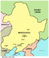
Manchukuo map.png 808 × 953; 52 KB
-
Manchukuo map ru.png 809 × 953; 37 KB
-
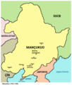
Manchukuo maptr.png 600 × 708; 99 KB
-
Manchukuo Railmap en.png 1,089 × 1,308; 315 KB
-
Manchukuo, Mengjiang and Nanjing in World War 2.png 1,406 × 983; 276 KB
-
Manchuoku regions1937 bel.png 720 × 803; 196 KB
-
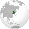
Manchuria (orthographic projection).png 998 × 999; 540 KB
-
Manchuria-map1944.jpg 572 × 748; 42 KB
-
Mançukuo haritası 1939.svg 634 × 387; 2.21 MB
-
Map depicting Chiyoda Park, Mukden.png 388 × 476; 370 KB
-
Map of Manchukuo Andong 1942.png 2,050 × 2,650; 441 KB
-
Map of Manchukuo Bei'an 1942.png 2,050 × 2,650; 441 KB
-
Map of Manchukuo Binjiang 1942.png 2,050 × 2,650; 442 KB
-
Map of Manchukuo divisions en.svg 651 × 726; 206 KB
-
Map of Manchukuo divisions zh-hans.svg 651 × 726; 237 KB
-
Map of Manchukuo divisions zh-hant.svg 651 × 726; 252 KB
-
Map of Manchukuo Dong'an 1942.png 2,050 × 2,650; 442 KB
-
Map of Manchukuo Fengtian 1942.png 2,050 × 2,650; 441 KB
-
Map of Manchukuo Heihe 1942.png 2,050 × 2,650; 441 KB
-
Map of Manchukuo Jiandao 1942.png 2,050 × 2,650; 441 KB
-
Map of Manchukuo Jilin 1942.png 2,050 × 2,650; 442 KB
-
Map of Manchukuo Jinzhou 1942.png 2,050 × 2,650; 441 KB
-
Map of Manchukuo Longjiang 1942.png 2,050 × 2,650; 442 KB
-
Map of Manchukuo Mudanjiang 1942.png 2,050 × 2,650; 441 KB
-
Map of Manchukuo Outline.svg 649 × 726; 15 KB
-
Map of Manchukuo Rehe 1942.png 2,050 × 2,650; 442 KB
-
Map of Manchukuo Sanjiang 1942.png 2,050 × 2,650; 442 KB
-
Map of Manchukuo Siping 1942.png 2,050 × 2,650; 441 KB
-
Map of Manchukuo Tonghua 1942.png 2,050 × 2,650; 441 KB
-
Map of Manchukuo Xing'an East 1942.png 2,050 × 2,650; 442 KB
-
Map of Manchukuo Xing'an South 1942.png 2,050 × 2,650; 442 KB
-
Map of Manchukuo Xing'an West 1942.png 2,050 × 2,650; 442 KB
-
Map of Manchukuo Xinjing 1942.png 2,050 × 2,650; 442 KB
-
Map of Manchuria 1942.jpg 2,400 × 2,979; 2.2 MB
-
MapaDeManchukúo.svg 808 × 953; 172 KB
-
MapofBinjiang.svg 400 × 225; 229 KB
-
Монголия-Манжго.png 811 × 580; 1.22 MB
-
満州国の位置.png 635 × 325; 88 KB
-
満州国の位置図.png 635 × 325; 89 KB
-
満州国吉林省市県旗.jpg 3,481 × 2,465; 481 KB
-
만주국.svg 808 × 953; 39 KB

