Category:Maps of Makassar
Jump to navigation
Jump to search
Wikimedia category | |||||
| Upload media | |||||
| Instance of | |||||
|---|---|---|---|---|---|
| Category combines topics | |||||
| Makassar | |||||
city and capital of South Sulawesi Province, Indonesia       | |||||
| Instance of |
| ||||
| Location | South Sulawesi, Indonesia | ||||
| Inception |
| ||||
| Population |
| ||||
| Area |
| ||||
| Elevation above sea level |
| ||||
| official website | |||||
 | |||||
Subcategories
This category has only the following subcategory.
Media in category "Maps of Makassar"
The following 13 files are in this category, out of 13 total.
-
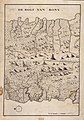
 Map of Makassar c. 1638.jpg 4,560 × 1,680; 1.68 MB
-
 AMH-8028-KB Floor plan of Fort Rotterdam at Makassar.jpg 1,733 × 2,400; 595 KB
-
 Admiralty Chart No 1293 Approach to Makassar, Published 1898.jpg 10,912 × 16,468; 50.27 MB
-
 Admiralty Chart No 2637 Strait of Makassar, Published 1885.jpg 10,920 × 16,073; 51.48 MB
-
 Admiralty Chart No 2662 Ports in Makassar Strait, Published 1859, Large Corrections 1903.jpg 10,893 × 16,406; 21.85 MB
-
 Admiralty Chart No 941b Eastern Archipelago Sheet 2. Macassar Road, Published 1867.jpg 8,058 × 11,856; 29.48 MB
-
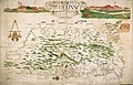 AMH-4679-NA Map and view of Macassar.jpg 2,400 × 1,549; 755 KB
-
 AMH-5484-NA Map of the area around Macassar and Bone on Celebes.jpg 1,682 × 2,400; 801 KB
-
 AMH-5488-NA Map of the city of Tjinrana Bone.jpg 2,400 × 1,679; 377 KB
-
 Location map Makassar.png 1,923 × 2,054; 2.38 MB
-

-
 Makassar south sulawesi.jpg 728 × 425; 143 KB
-
 Peta Kecamatan Tamalanrea, Kota Makassar.jpg 1,280 × 1,280; 328 KB


