Category:Maps of Lugano District
Jump to navigation
Jump to search
Media in category "Maps of Lugano District"
The following 24 files are in this category, out of 24 total.
-
 Karte Quartiere Bezirk Lugano 2013.png 1,476 × 1,684; 628 KB
-
 Karte Quartiere Bezirk Lugano 2013-it (vector).svg 898 × 1,026; 611 KB
-
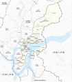
 Karte Quartiere Bezirk Lugano 2013-it.png 897 × 1,023; 352 KB
-
 Karte Quartier Barbengo 2013.png 1,476 × 1,684; 660 KB
-
 Karte Quartier Besso 2013.png 1,476 × 1,684; 660 KB
-
 Karte Quartier Breganzona 2013.png 1,476 × 1,684; 660 KB
-
 Karte Quartier Bré-Aldesago 2013.png 1,476 × 1,684; 660 KB
-
 Karte Quartier Cadro 2013.png 1,476 × 1,684; 660 KB
-
 Karte Quartier Carabbia 2013.png 1,476 × 1,684; 660 KB
-
 Karte Quartier Carona 2013.png 1,476 × 1,684; 660 KB
-
 Karte Quartier Castagnola-Cassarate 2013.png 1,476 × 1,684; 661 KB
-
 Karte Quartier Cureggia 2013.png 1,476 × 1,684; 660 KB
-
 Karte Quartier Davesco-Soragno 2013.png 1,476 × 1,684; 660 KB
-
 Karte Quartier Gandria 2013.png 1,476 × 1,684; 660 KB
-
 Karte Quartier Loreto 2013.png 1,476 × 1,684; 660 KB
-
 Karte Quartier Lugano Centro 2013.png 1,476 × 1,684; 660 KB
-
 Karte Quartier Molino Nuovo 2013.png 1,476 × 1,684; 660 KB
-
 Karte Quartier Pambio Noranco 2013.png 1,476 × 1,684; 660 KB
-
 Karte Quartier Pazzallo 2013.png 1,476 × 1,684; 660 KB
-
 Karte Quartier Pregassona 2013.png 1,476 × 1,684; 660 KB
-
 Karte Quartier Sonvico 2013.png 1,476 × 1,684; 660 KB
-
 Karte Quartier Valcolla 2013.png 1,476 × 1,684; 659 KB
-
 Karte Quartier Viganello 2013.png 1,476 × 1,684; 660 KB
-
 Karte Quartier Villa Luganese 2013.png 1,476 × 1,684; 660 KB

.svg)


