Category:Maps of Long Valley Caldera
Jump to navigation
Jump to search
Maps of the Long Valley Caldera a volcanic and geothermal area in Mono County, eastern California.
Wikimedia category | |||||
| Upload media | |||||
| Instance of | |||||
|---|---|---|---|---|---|
| Category combines topics | |||||
| Long Valley Caldera | |||||
depression in California, United States | |||||
| Instance of | |||||
| Location | California, Pacific States Region | ||||
| Mountain range | |||||
 | |||||
Media in category "Maps of Long Valley Caldera"
The following 15 files are in this category, out of 15 total.
-
CalderaRelief large.png 620 × 574; 297 KB
-
Geo Environ Analysis - Surprise, Warner, and Long Valleys - allotments.jpg 2,001 × 5,041; 12.3 MB
-
Geo Environ Analysis - Surprise, Warner, and Long Valleys - archaeological areas.jpg 1,966 × 5,152; 15.31 MB
-
Geo Environ Analysis - Surprise, Warner, and Long Valleys - critical wildlife habitat.jpg 1,956 × 5,225; 13.09 MB
-
Geo Environ Analysis - Surprise, Warner, and Long Valleys - environmentally sensitive areas.jpg 2,021 × 5,194; 13.61 MB
-
Geo Environ Analysis - Surprise, Warner, and Long Valleys - physiographic regions.jpg 2,016 × 5,113; 8.13 MB
-
Geo Environ Analysis - Surprise, Warner, and Long Valleys - soil erosion.jpg 1,988 × 5,133; 12.61 MB
-
Geo Environ Analysis - Surprise, Warner, and Long Valleys - soil series.jpg 1,986 × 5,107; 12.78 MB
-
Geo Environ Analysis - Surprise, Warner, and Long Valleys - water resources.jpg 2,000 × 5,113; 13.66 MB
-
Geo Environ Analysis - Surprise, Warner, and Long Valleys - wild horse and burro mgmt.jpg 1,950 × 5,142; 13.57 MB
-
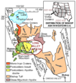
Geologic map of Long Valley and Mono Basin region (USGS).png 300 × 325; 10 KB
-
LongValleyMap-en.gif 1,296 × 1,464; 222 KB
-
LongValleyMap-fr.gif 324 × 366; 18 KB
-
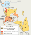
Map of Long Valley Mono area.png 600 × 668; 178 KB
-
MonoCraters LongValley.gif 1,200 × 1,336; 215 KB


