Category:Maps of Loire River in Loiret
Jump to navigation
Jump to search
Subcategories
This category has the following 28 subcategories, out of 28 total.
M
Media in category "Maps of Loire River in Loiret"
The following 7 files are in this category, out of 7 total.
-
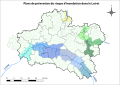 45-PPRI.svg 843 × 597; 1.12 MB
-
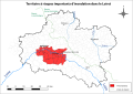 45-TRI.svg 843 × 597; 6.07 MB
-
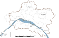 45-ZI-Digues.png 5,457 × 3,543; 1.56 MB
-
 France Loire Orleans.svg 185 × 181; 231 KB
-
 France-LoireGien.png 227 × 227; 3 KB
-
 FranceLoireGien.PNG 114 × 114; 2 KB
-


