Category:Maps of Liège in the 19th century
Jump to navigation
Jump to search
Media in category "Maps of Liège in the 19th century"
The following 17 files are in this category, out of 17 total.
-
 Meyer‘s Zeitungsatlas 066 – Belgien und Luxemburg.jpg 7,309 × 6,272; 16.03 MB
-
 Map of Liège in the 19th century-st-jacques.jpg 657 × 612; 147 KB
-
 Areines Liege-plan 1856.jpg 3,268 × 2,440; 1.07 MB
-
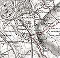 Gare de Longdoz 1850 - Carte de Vandermaelen.jpg 861 × 838; 1.06 MB
-
 Gare de Longdoz 1865 - Carte du dépôt de la guerre.jpg 861 × 838; 1.23 MB
-
 Image taken from page 355 of 'Liége au XIX.me siècle. La vie. Orné ... de ... vues, etc'.jpg 5,007 × 3,296; 10.03 MB
-

-
 Liège - guide Baedeker Belgique et Hollande (1897) - Fontaines Montefiore.jpg 2,547 × 3,316; 5.2 MB
-
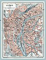
 Liège - guide Baedeker Belgique et Hollande (1897).jpg 2,403 × 3,172; 5.14 MB
-

-
 Map liege 4.jpg 559 × 450; 63 KB
-
 Map liege 5.jpg 6,498 × 8,203; 18.63 MB
-
 Maps of Liège in the 19th century.jpg 8,072 × 6,173; 5.5 MB
-
 Plan de Liège 1885.jpg 3,039 × 2,000; 2.95 MB
-
 Plan Liège 1838.png 2,943 × 2,387; 17.26 MB
-
 Plan université par Chevron.jpg 3,408 × 5,120; 18.74 MB
-
 Projet d'appropriation des terrains de l'Ile et du Bassin de commerce.jpg 5,932 × 4,613; 5.85 MB


_%E2%80%94_Plan_extrait_du_guide_%22Baedeker_Belgique_et_Hollande%22,_%C3%A9dition_de_1897.jpg)
_-_Fontaines_Montefiore.jpg)
.jpg)
_%E2%80%94_Kaart_van_de_gids_%22Baedeker_Belgi%C3%AB_en_Holland%22,_Franse_editie_van_1897.jpg)


