Category:Maps of Lesser Poland Voivodeship
Jump to navigation
Jump to search
Voivodeships of Poland: Greater Poland · Kuyavian-Pomeranian · Lesser Poland · Łódź · Lower Silesian · Lublin · Lubusz · Masovian · Opole · Podlaskie · Pomeranian · Silesian · Subcarpathian · Świętokrzyskie · Warmian-Masurian · West Pomeranian ·

Wikimedia category | |||||
| Upload media | |||||
| Instance of | |||||
|---|---|---|---|---|---|
| Category combines topics | |||||
| Lesser Poland Voivodeship | |||||
voivodeship of Poland .jpg)      | |||||
| Instance of | |||||
| Named after | |||||
| Location | Poland | ||||
| Capital | |||||
| Has part(s) | |||||
| Inception |
| ||||
| Population |
| ||||
| Area |
| ||||
| Different from | |||||
| official website | |||||
 | |||||
Subcategories
This category has the following 10 subcategories, out of 10 total.
Pages in category "Maps of Lesser Poland Voivodeship"
This category contains only the following page.
Media in category "Maps of Lesser Poland Voivodeship"
The following 36 files are in this category, out of 36 total.
-
 Aglomeracja Tarnowska.png 1,200 × 1,036; 670 KB
-
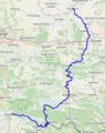 Dunajec.png 428 × 539; 223 KB
-
 European Parliament constituencies Poland (10).png 902 × 849; 43 KB
-
 Gmina-Czarny-Dunajec.png 536 × 258; 10 KB
-

-
 Krakowskie sandomierskie lubelskie.png 1,932 × 1,755; 347 KB
-
 Las Gościbia mapa.png 1,255 × 829; 111 KB
-
 Lesser Poland Voivodeship administrative map.svg 1,147 × 929; 4.82 MB
-
 Lesser Poland Voivodeship Flag Map.svg 939 × 801; 13 KB
-
 Malopolska Krakowskie sandomierskie lubelskie1.png 1,932 × 1,755; 279 KB
-
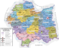
 Malopolskie mapa administracyjna.png 2,008 × 1,733; 675 KB
-
 Malopolskie mapa fizyczna.png 2,007 × 1,733; 660 KB
-
 Malopolskie powiat map numbers.png 776 × 696; 105 KB
-
 Malopolskie topo.png 1,976 × 1,916; 5.87 MB
-
 MAna49.png 2,476 × 2,172; 157 KB
-
 Mapa Podłęża.jpg 1,020 × 456; 86 KB
-
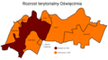 Mapa rozrostu terytorialnego Oświęcimia.png 3,840 × 2,160; 602 KB
-
 Medieval borderland between Silesia and Lesser Poland.png 1,400 × 2,000; 3.89 MB
-
 Miejsca noclegowe.PNG 782 × 724; 40 KB
-
 Mędrzechów.png 731 × 600; 103 KB
-
 PL Tatra Montains National Park.svg 1,844 × 1,219; 70 KB
-
 Podział administracyjny Oświęcimia na osiedla.png 4,096 × 3,072; 535 KB
-
 POL województwo małopolskie map partition idea for Wikivoyage.png 669 × 600; 119 KB
-
 Polen BV043433842.jpg 4,616 × 3,630; 3.11 MB
-
 Położenie Łowczowa na mapie gminy Tuchów.png 450 × 627; 59 KB
-
 Przedsiębiorczość.PNG 782 × 724; 40 KB
-
 Rączna, szczegółowa mapa.png 2,117 × 2,025; 560 KB
-
 Szlak cysterski na mapie Polski.png 520 × 520; 41 KB
-
 Vnitřní Západní Karpaty, b11.svg 1,000 × 600; 106 KB
-
 Vnější Západní Karpaty, i.svg 999 × 666; 99 KB
-
 Vnější Západní Karpaty, i3.svg 999 × 666; 99 KB
-
 Wieliczka Mapa.PNG 580 × 425; 54 KB
-
 Województwo małopolskie powiaty.svg 315 × 211; 53 KB
-
 Województwo małopolskie powiaty2018.png 832 × 730; 223 KB
-
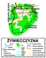 Żywiecczyzna-map PL.png 560 × 700; 108 KB
-
 波蘭奧斯威辛集中營博物館(世界遺產)11.jpg 3,008 × 2,000; 1.64 MB


.png)


11.jpg)