Category:Maps of Lesquerde
Jump to navigation
Jump to search
Wikimedia category | |||||
| Upload media | |||||
| Instance of | |||||
|---|---|---|---|---|---|
| Category combines topics | |||||
| Lesquerde | |||||
commune in Pyrénées-Orientales, France  .svg)  | |||||
| Pronunciation audio | |||||
| Instance of | |||||
| Location | |||||
| Located in or next to body of water | |||||
| Head of government |
| ||||
| Population |
| ||||
| Area |
| ||||
| official website | |||||
 | |||||
Media in category "Maps of Lesquerde"
The following 5 files are in this category, out of 5 total.
-
 66097-Lesquerde-argile.png 4,076 × 3,307; 6.45 MB
-
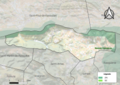 66097-Lesquerde-Natura2000.png 5,846 × 4,133; 12.36 MB
-
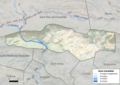
 66097-Lesquerde-ZNIEFF1.png 3,057 × 2,480; 6.53 MB
-
 66097-Lesquerde-ZNIEFF2.png 3,519 × 2,480; 5.51 MB
-
 66097-Lesquerde-Zone inondable.png 4,677 × 3,307; 8.75 MB


