Category:Maps of Les Écrennes
Jump to navigation
Jump to search
Wikimedia category | |||||
| Upload media | |||||
| Instance of | |||||
|---|---|---|---|---|---|
| Category combines topics | |||||
| Les Écrennes | |||||
commune in Seine-et-Marne, France  .svg)  | |||||
| Instance of | |||||
| Location |
| ||||
| Head of government |
| ||||
| Population |
| ||||
| Area |
| ||||
| official website | |||||
 | |||||
Media in category "Maps of Les Écrennes"
The following 11 files are in this category, out of 11 total.
-
 77165-Les Écrennes - Localisation.png 2,500 × 2,480; 1.42 MB
-
 77165-Les Écrennes - Relief-PlanIgn.png 7,015 × 4,960; 5.98 MB
-
 77165-Les Écrennes-Cadastre.png 7,015 × 4,960; 4.52 MB
-
 77165-Les Écrennes-Géologie.png 7,015 × 4,960; 3.45 MB
-
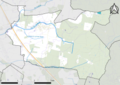
 77165-Les Écrennes-Hydro.png 7,015 × 4,960; 2.83 MB
-
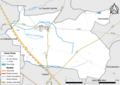
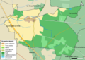
 77165-Les Écrennes-Natura 2000.png 7,015 × 4,960; 2.74 MB
-
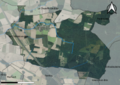 77165-Les Écrennes-Orthophoto.png 7,015 × 4,960; 7.03 MB
-
 77165-Les Écrennes-Sols.png 7,015 × 4,960; 2.82 MB
-
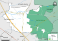
 77165-Les Écrennes-ZNIEFF1.png 7,015 × 4,960; 2.5 MB
-
 77165-Les Écrennes-ZNIEFF2.png 7,015 × 4,960; 2.71 MB
-
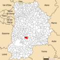
 Map commune FR insee code 77165.png 756 × 605; 34 KB


