Category:Maps of Le Plessis-L'Échelle
Jump to navigation
Jump to search
Media in category "Maps of Le Plessis-L'Échelle"
The following 7 files are in this category, out of 7 total.
-
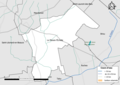 41178-Le Plessis-l'Échelle-Cours eau.png 3,507 × 2,480; 1.01 MB
-
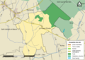
 41178-Le Plessis-l'Échelle-Natura2000-ZPS.png 3,507 × 2,480; 1.14 MB
-
 41178-Le Plessis-l'Échelle-Sols.png 7,015 × 4,960; 3.12 MB
-
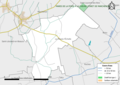 41178-Le Plessis-l'Échelle-ZNIEFF1.png 3,507 × 2,480; 1.12 MB
-
 41178-Le Plessis-l'Échelle-ZNIEFF2.png 3,507 × 2,480; 1.16 MB
-
 Le Plessis-L'Échelle dans son Intercommunalité.png 2,000 × 1,684; 410 KB
-
 Map commune FR insee code 41178.png 756 × 605; 25 KB


