Category:Maps of Le Mesnil-Amelot
Jump to navigation
Jump to search
Wikimedia category | |||||
| Upload media | |||||
| Instance of | |||||
|---|---|---|---|---|---|
| Category combines topics | |||||
| Le Mesnil-Amelot | |||||
commune in Seine-et-Marne, France ,_nouvelle_mairie,_rue_du_Chapeau.jpg)  | |||||
| Instance of | |||||
| Location |
| ||||
| Head of government |
| ||||
| Population |
| ||||
| Area |
| ||||
| official website | |||||
 | |||||
Media in category "Maps of Le Mesnil-Amelot"
The following 11 files are in this category, out of 11 total.
-
 77291-Le Mesnil-Amelot - Localisation.png 2,500 × 2,480; 1.42 MB
-
 77291-Le Mesnil-Amelot - Relief-PlanIgn.png 7,015 × 4,960; 7.7 MB
-
 77291-Le Mesnil-Amelot-Cadastre.png 7,015 × 4,960; 4.97 MB
-
 77291-Le Mesnil-Amelot-Géologie.png 7,015 × 4,960; 3.05 MB
-
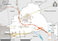 77291-Le Mesnil-Amelot-Hydro.png 7,015 × 4,960; 3.75 MB
-
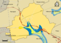
 77291-Le Mesnil-Amelot-Natura 2000.png 7,015 × 4,960; 2.52 MB
-
 77291-Le Mesnil-Amelot-Orthophoto.png 7,015 × 4,960; 5.05 MB
-
 77291-Le Mesnil-Amelot-Sols.png 7,015 × 4,960; 2.79 MB
-
 77291-Le Mesnil-Amelot-ZNIEFF1.png 7,015 × 4,960; 2.57 MB
-
 77291-Le Mesnil-Amelot-ZNIEFF2.png 7,015 × 4,960; 2.58 MB
-
 Map commune FR insee code 77291.png 756 × 605; 44 KB


