Category:Maps of Latour-Bas-Elne
Jump to navigation
Jump to search
Wikimedia category | |||||
| Upload media | |||||
| Instance of | |||||
|---|---|---|---|---|---|
| Category combines topics | |||||
| Latour-Bas-Elne | |||||
commune in Pyrénées-Orientales, France   | |||||
| Pronunciation audio | |||||
| Instance of | |||||
| Location |
| ||||
| Head of government |
| ||||
| Population |
| ||||
| Area |
| ||||
| Elevation above sea level |
| ||||
| official website | |||||
 | |||||
Media in category "Maps of Latour-Bas-Elne"
The following 7 files are in this category, out of 7 total.
-
 66094-Latour-Bas-Elne-argile.png 4,076 × 3,307; 2.68 MB
-
 66094-Latour-Bas-Elne-Natura2000.png 5,846 × 4,133; 5.64 MB
-
 66094-Latour-Bas-Elne-Sols.png 3,270 × 2,598; 2.32 MB
-
 66094-Latour-Bas-Elne-ZNIEFF1.png 3,057 × 2,480; 2.81 MB
-
 66094-Latour-Bas-Elne-ZNIEFF2.png 3,519 × 2,480; 3.18 MB
-
 66094-Latour-Bas-Elne-Zone inondable.png 4,677 × 3,307; 3.77 MB
-
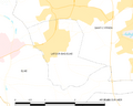 Map commune FR insee code 66094.png 756 × 605; 23 KB


