Category:Maps of Lasserre (Ariège)
Jump to navigation
Jump to search
Wikimedia category | |||||
| Upload media | |||||
| Instance of | |||||
|---|---|---|---|---|---|
| Category combines topics | |||||
| Lasserre | |||||
commune in Ariège, France _-_Vue_g%C3%A9n%C3%A9rale.jpg) _OSM_01.png) | |||||
| Instance of | |||||
| Location |
| ||||
| Street address |
| ||||
| Head of government |
| ||||
| Population |
| ||||
| Area |
| ||||
| Elevation above sea level |
| ||||
| Different from | |||||
 | |||||
Media in category "Maps of Lasserre (Ariège)"
The following 11 files are in this category, out of 11 total.
-
 09158-Lasserre-argile.png 4,076 × 3,307; 4.32 MB
-
 09158-Lasserre-Natura2000.png 7,015 × 4,960; 8.29 MB
-
 09158-Lasserre-Natura2000b.png 5,846 × 4,133; 6.09 MB
-
 09158-Lasserre-Routes-Hydro.png 3,507 × 2,480; 1.77 MB
-
 09158-Lasserre-Sols.png 3,507 × 2,480; 1.92 MB
-
 09158-Lasserre-ZNIEFF1.png 3,519 × 2,480; 4.77 MB
-
 09158-Lasserre-ZNIEFF2.png 3,519 × 2,480; 4.48 MB
-
 Lasserre (Ariège) OSM 01.png 347 × 395; 59 KB
-
 Lasserre (Ariège) OSM 02.png 347 × 395; 154 KB
-
 Lasserre (Ariège) OSM 03.png 588 × 554; 290 KB
-
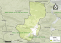
 Map commune FR insee code 09158.png 756 × 605; 47 KB


_OSM_02.png)
_OSM_03.png)
