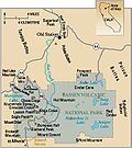
Category:Maps of Lassen volcano
Appearance
Media in category "Maps of Lassen volcano"
The following 10 files are in this category, out of 10 total.
-
Cinder Cone Lassen geologic map-explanation.png 478 × 242; 81 KB
-
Cinder Cone Lassen geologic map.png 373 × 535; 207 KB
-
Cinder Cone Lassen locator map.png 334 × 356; 11 KB
-
Deposits from May 1915 eruption of Lassen Peak.jpg 981 × 677; 99 KB
-
Eruptions in the Lassen area in the last 50,000 years-map.jpg 335 × 378; 34 KB
-
Geothermal areas in Lassen area.gif 632 × 437; 54 KB
-
Lassen Peak geologic map.png 1,326 × 594; 1.19 MB
-
NPS lassen-volcanic-geologic-map.jpg 4,661 × 2,812; 2.65 MB
-
PSM V86 D295 The 1882 usgs survey of lassen peak and vicinity.jpg 3,053 × 1,980; 1.56 MB
-
Rockland Ash map.png 283 × 334; 8 KB


