Category:Maps of Lanthes
Jump to navigation
Jump to search
Wikimedia category | |||||
| Upload media | |||||
| Instance of | |||||
|---|---|---|---|---|---|
| Category combines topics | |||||
| Lanthes | |||||
commune in Côte-d'Or, France  .svg)  | |||||
| Instance of | |||||
| Location |
| ||||
| Street address |
| ||||
| Population |
| ||||
| Area |
| ||||
| Elevation above sea level |
| ||||
 | |||||
Media in category "Maps of Lanthes"
The following 5 files are in this category, out of 5 total.
-
 21340-Lanthes-Hydro.jpeg 5,846 × 4,133; 1.24 MB
-
 21340-Lanthes-Sols.png 3,270 × 2,598; 938 KB
-
 Lanthes 2013 03 04 04.jpg 3,030 × 2,036; 5.14 MB
-
 Lanthes 2013 03 04 09.jpg 3,030 × 2,036; 5.28 MB
-
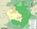
 Map commune FR insee code 21340.png 756 × 605; 33 KB


