Category:Maps of Lanester (Morbihan)
Jump to navigation
Jump to search
Media in category "Maps of Lanester (Morbihan)"
The following 9 files are in this category, out of 9 total.
-
 56098-Lanester-Sols.png 3,270 × 2,598; 5.06 MB
-
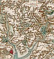 Carte de Cassini Caudan.jpg 804 × 877; 679 KB
-
 Caudan Lanester Carte 1758.jpg 1,180 × 622; 518 KB
-
 Lanester limite communale.jpg 1,329 × 822; 202 KB
-
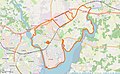
 Lanester opentopomap.png 1,347 × 1,277; 2.71 MB
-
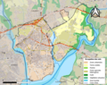
 Map commune FR insee code 56098.png 756 × 605; 107 KB
-
 Plan Caudan Lanester 1758 2.jpg 1,321 × 892; 882 KB
-
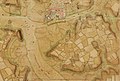
 Plan Caudan Lanester 1779.jpg 1,342 × 899; 1.16 MB
-
 Plan Rade Lorient XVIIe siècle.jpg 1,355 × 899; 611 KB


