Category:Maps of Lake Peipus
Jump to navigation
Jump to search
Media in category "Maps of Lake Peipus"
The following 17 files are in this category, out of 17 total.
-
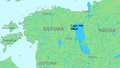 Lake Peipus.png 782 × 444; 106 KB
-
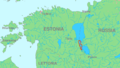 Lammijarv location.png 782 × 444; 100 KB
-
 Landkarte Peipussee.PNG 327 × 351; 15 KB
-
 Narva basin map hu.svg 743 × 1,053; 2.45 MB
-
 Narva basin map.svg 743 × 1,053; 2.46 MB
-
 Narva Becken mit Einzugsgebieten-Deutsch.svg 743 × 1,053; 2.41 MB
-
 Peipsi jarv location.png 782 × 444; 100 KB
-
 Pihkva jarv location.png 782 × 444; 100 KB
-
 Talabskie ostrova.jpg 819 × 522; 55 KB
-
 USSR map NO 35-5 Tartu.jpg 5,744 × 4,356; 6.34 MB
-
 Карта бассейна Нарвы.svg 743 × 1,053; 2.43 MB
-
 Местоположение Чудского озера.png 782 × 444; 113 KB
-
 Псковское озеро.png 384 × 408; 69 KB
-
 Русские-старообрядцы-Эстонии.png 600 × 797; 92 KB
-
 Теплое озеро.png 362 × 383; 118 KB
-
 Чудское озеро на карте.png 399 × 399; 72 KB
-
 納爾瓦河-流域-水系.svg 743 × 1,053; 3.31 MB


