Category:Maps of Lake Garda
Jump to navigation
Jump to search
Media in category "Maps of Lake Garda"
The following 20 files are in this category, out of 20 total.
-
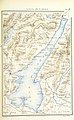
 Atti della Società italiana di scienze naturali (1864) (20348138555).jpg 2,196 × 2,952; 908 KB
-

-

-
 348 of 'La Penisola di Sirmione sul Lago di Garda illustrata' (11047641295).jpg 2,365 × 3,510; 1.13 MB
-

-
-
 Carta topografica della riva sud – occidentale del lago di Garda, da Moniga a Sirmione.jpg 3,383 × 4,596; 13.21 MB
-
 ETH-BIB-Karte Gardasee-Euganeen-Dia 247-Z-00332.tif 3,625 × 2,949; 30.7 MB
-
 Karte Gardasee INSELN noBG.png 1,717 × 2,000; 127 KB
-
 Karte Gardasee noBG.png 1,558 × 2,000; 96 KB
-
 Lago di Garda localizzazione.svg 736 × 482; 1.63 MB
-

-
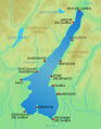 Mappalagodigarda.png 356 × 457; 61 KB
-
 Ora del Garda.jpg 930 × 1,388; 497 KB
-
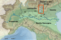
 Schéma des 2 marges continentales des alpes.png 705 × 454; 127 KB
-
 Territorio di Brescia e di Crema 1500s.jpg 4,064 × 3,057; 7.88 MB
-
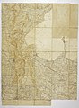
 Territorio di Verona - CBT 5881752.jpg 5,451 × 4,278; 6.89 MB
-
 Vincenzo coronelli tavola topografica della riviera 1694 I.png 1,251 × 842; 2.28 MB
-
 Vincenzo coronelli tavola topografica della riviera 1694 II.png 1,255 × 839; 2.13 MB
-
 Vincenzo coronelli tavola topografica della riviera 1694.png 606 × 823; 1.11 MB
_(20348138555).jpg)
_(14776739794).jpg)
.jpg)
.jpg)
_E._H._(and)_W._v._Tr%C3%BCtzschler,_etc%27_(11243660026).jpg)
%27_(11248252076).jpg)


.jpg)


