Category:Maps of La Villedieu (Creuse)
Jump to navigation
Jump to search
Wikimedia category | |||||
| Upload media | |||||
| Instance of | |||||
|---|---|---|---|---|---|
| Category combines topics | |||||
| La Villedieu | |||||
commune in Creuse, France .jpg)  | |||||
| Instance of | |||||
| Location |
| ||||
| Street address |
| ||||
| Population |
| ||||
| Area |
| ||||
| Different from | |||||
 | |||||
Media in category "Maps of La Villedieu (Creuse)"
The following 3 files are in this category, out of 3 total.
-
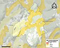 23264-La Villedieu-argile.jpg 3,057 × 2,480; 554 KB
-
 23264-La Villedieu-Routes-Hydro.svg 1,056 × 744; 1.51 MB
-
 23264-La Villedieu-ZNIEFF1.jpg 3,519 × 2,480; 462 KB


