Category:Maps of La Panouse
Jump to navigation
Jump to search
Media in category "Maps of La Panouse"
The following 8 files are in this category, out of 8 total.
-
 48108-La Panouse-argile.jpg 3,057 × 2,480; 632 KB
-
 48108-La Panouse-Hydro.png 3,507 × 2,480; 4.99 MB
-
 48108-La Panouse-Natura2000b.png 5,846 × 4,133; 7.8 MB
-
 48108-La Panouse-Routes-Hydro.png 3,507 × 2,480; 1.8 MB
-
 48108-La Panouse-Sols.png 3,270 × 2,598; 1.88 MB
-
 48108-La Panouse-ZNIEFF1.png 3,057 × 2,480; 4.24 MB
-
 48108-La Panouse-ZNIEFF2.png 3,519 × 2,480; 4.49 MB
-
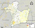
 Map commune FR insee code 48108.png 756 × 605; 63 KB


